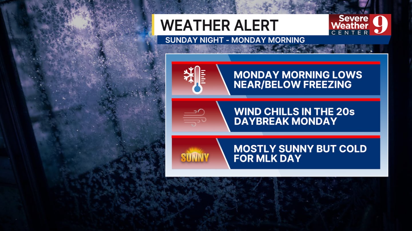
CENTRAL FLORIDA — Cold temperatures will arrive late tonight into Monday, thanks to another strong cold front moving into Central Florida.
That front that will move in on Sunday will take advantage of that humidity and bring decent rain chances by the late morning and early afternoon.
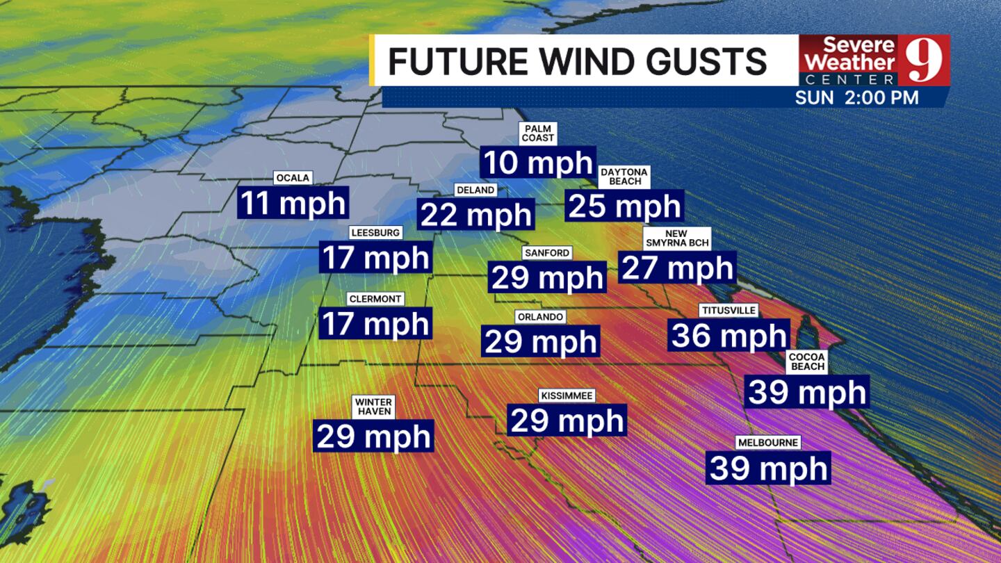
No severe weather or heavy rain is expected, but strong gusts may occur at times.
Those winds will translate into a strong wind chill for the rest of the day Sunday and into Monday morning.
We have a wind advisory in effect for much of Central Florida between noon and 5:00 today.
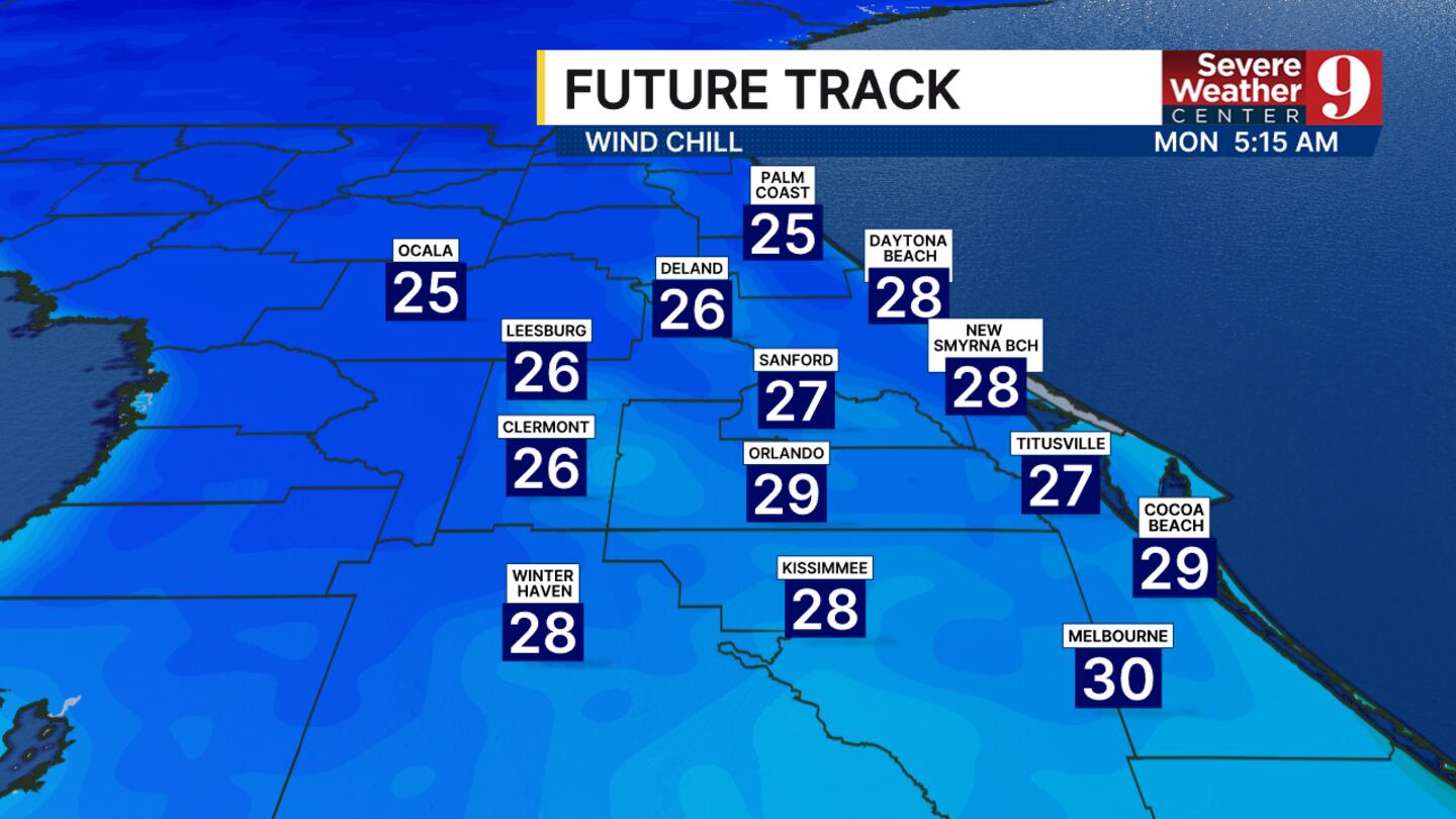
We may even have wind chills in the upper thirties shortly after sunset around the Orlando Metro area.
,
The actual temperatures on Monday morning could fall to at least the mid-30s.
Depending on how quickly the front moves through and how dry the air becomes, Orlando has a chance to drop to freezing again.
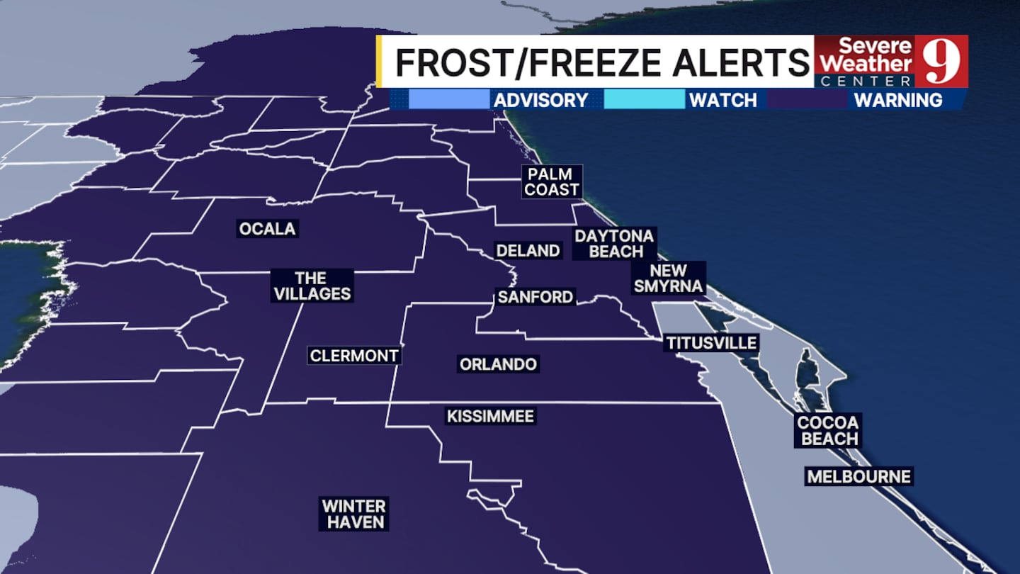
A freeze warning has already been posted for the vast majority of Central Florida.
We should begin to see temperatures return to near normal by either Wednesday or Thursday before another front moves into the area.
Click here to download our free news, weather and smart TV apps. And click here to stream Channel 9 Eyewitness News live.

©2026 Cox Media Group


