ORLANDO, Fla. — >> CLICK HERE FOR LIVE DOPPLER 9 RADAR <<
Central Florida should expect another hot and muggy day to begin the workweek, with chances of storms in the afternoon.
Here’s what can be expected:
- Temps were the lower 90s, the humidity made it feel as if temps were in the triple digits for some
- The general storm movement was from the southwest to the northeast.
- Early evening showers and storms affecting Osceola County by 6 p.m.
- Showers and storms will taper off by 9 p.m.
The heat and humidity will continue on Tuesday, but the sea breeze will spark the typical afternoon thunderstorms across Central Florida.
Read: Forecasters highly confident about an active 2020 Hurricane Season
Read More: Pacific storm remnants stuck in Central American Gyre; Tropical Depression 3 forms
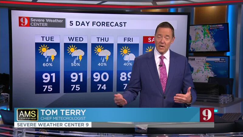
Watch your full 5 Day Forecast below:
DOWNLOAD OUR FREE WFTV WEATHER APP TO RECEIVE ALERTS
Entérese del pronóstico del tiempo, en español, por nuestra meteoróloga Irene Sans:
Follow our Severe Weather team on Twitter for live updates:
- Chief meteorologist Tom Terry
- Brian Shields
- Irene Sans
- Kassandra Crimi
- George Waldenberger
- Rusty McCranie
© 2020 Cox Media Group