ORLANDO, Fla. — The cold front we have been tracking for the past couple of days will now move through central Florida. Temperatures will begin to fall today, and we could see one or two passing showers this afternoon.
Afternoon temperatures will remain in the mid to upper 70s, and we will see more cloud cover across the region.
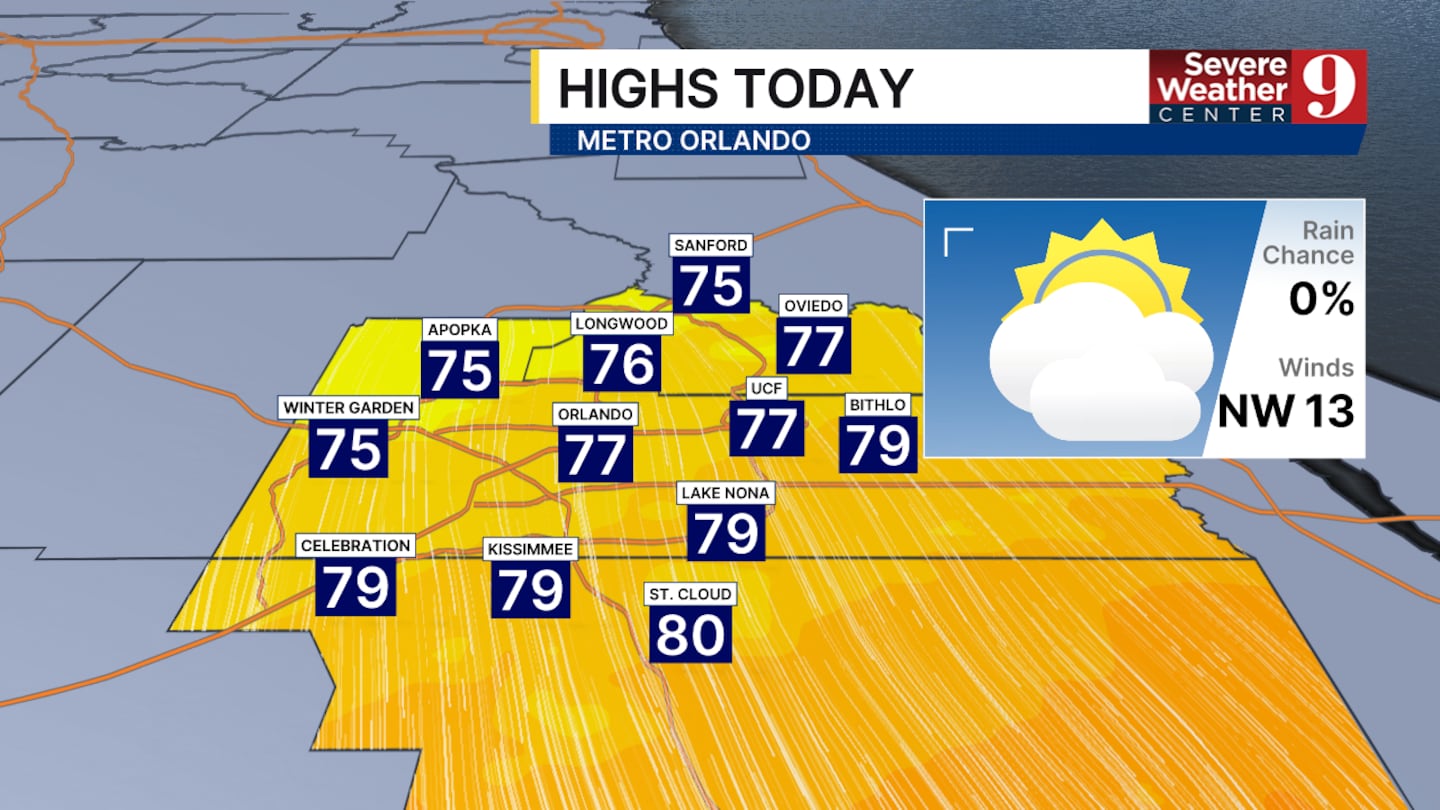
A few small passing showers are possible in the late morning and early afternoon; however, widespread rain is unlikely.
Tomorrow, our temperatures will be noticeably cooler. Highs will be back around 70° for a couple of days before another cool-down heads our way.
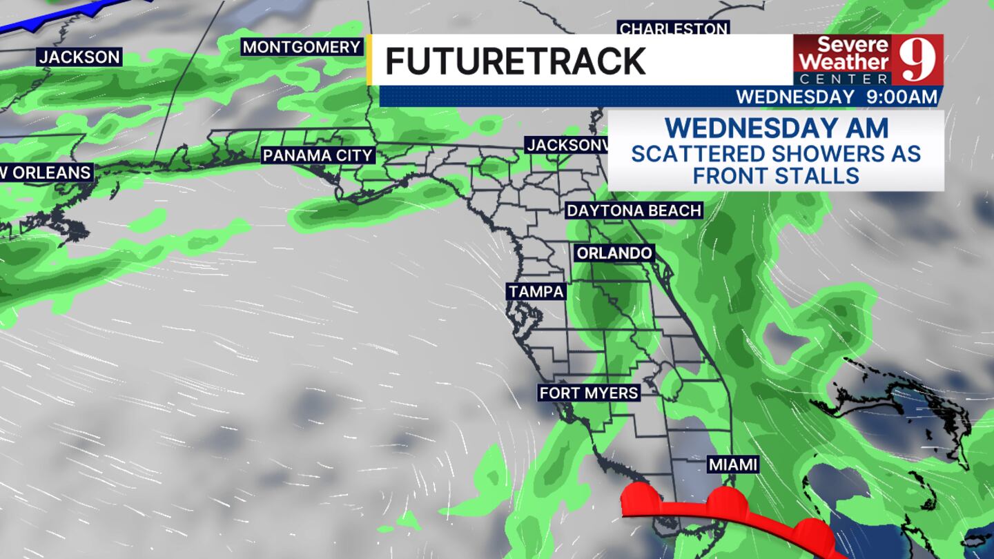
The next front is expected to arrive on Wednesday and will be the largest change we have seen in the past couple of months.
Widespread showers will be possible most of Wednesday and Thursday. Rain totals could reach half an inch. No severe weather impacts are expected.
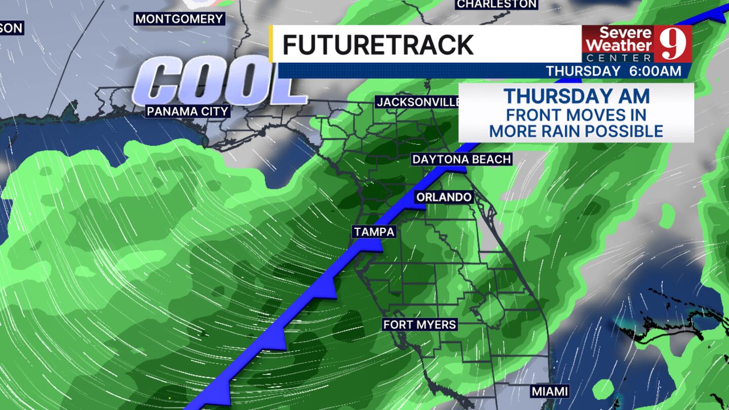
The bigger change will be the temperatures. Afternoon highs will fall to around 60° by next weekend. Morning lows could drop into the lower 30s north of Orlando and into the upper 30s in the city.
These numbers will fluctuate a lot before the system arrives so we will keep you updated as new information becomes available.
Click here to download our free news, weather and smart TV apps. And click here to stream Channel 9 Eyewitness News live.

©2026 Cox Media Group


