
ORLANDO, Fla. — >> CLICK HERE FOR LIVE DOPPLER 9 RADAR <<
Storm chances will stay high across Central Florida.
Make sure to always have at least three ways of receiving weather alerts. You can download our Free WFTV Weather App (make sure to allow notifications) to receive alerts wherever you are located.
Here’s what you can expect:
- Temperatures reached the low 90s across our area, some spots even coming to 95 degrees. Heat indices were over 103 degrees for many locations by noon.
- Afternoon storms have developed minor flooding, especially in Brevard and Flagler Counties.
- Rain and storms will cease after 9 p.m. for Central Florida.
- Temps will drop to the upper 70s with cloudy conditions for the evening.
For Wednesday:
- The weather will remain mostly unstable. Expect a repeat of today’s setup on Wednesday.
- Highs will be in the low-90s, but heat indices will be around 103 to 105 degrees.
- Storms that develop may cause minor flooding and frequent lightning.
>> WATCH OUR NEWSCAST LIVE HERE <<
This happened in Central Florida: Lightning strikes crane near hotel construction site at Disney World
Read: Saharan Dust coming to Central Florida: What is it? What does it do?
DOWNLOAD OUR FREE WFTV WEATHER APP TO RECEIVE ALERTS
Read: Forecasters highly confident about an active 2020 Hurricane Season
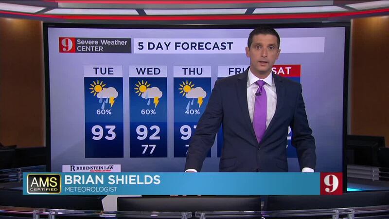
Watch your 5-day forecast below:
Entérese de todo lo que ocurre en el trópico en nuestra pagina en español.
Follow our Severe Weather team on Twitter for live updates:
- Chief meteorologist Tom Terry
- Brian Shields
- Irene Sans
- Kassandra Crimi
- George Waldenberger
- Rusty McCranie
© 2020 Cox Media Group


