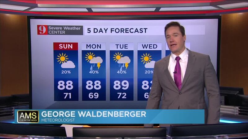
Expect scattered, fast-moving storms over Central Florida through the early evening. Overnight storms will cease and much better weather for Sunday.
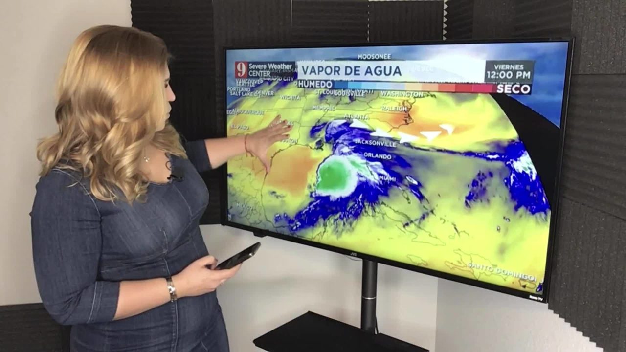
2:00 p.m. update: Post-tropical cyclone Nestor has made landfall on St. Vincent Island.
#Nestor makes landfall on St. Vincent Island, #Florida as a post-tropical cyclone. #WFTV #FLwx #Florida pic.twitter.com/IvMyKciVjb
— George Waldenberger (@GWaldenWFTV) October 19, 2019
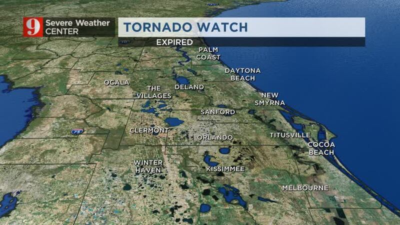
Tornado watch has been extended until 2pm for Volusia, Brevard, Seminole, Orange and Osceola counties. pic.twitter.com/Zttqlt2Ga1
— Kassandra Crimi (@KCrimiWFTV) October 19, 2019
Nestor is now considered to be post-tropical as it moves closer to the panhandle. pic.twitter.com/XwuCrMFnB0
— Rusty McCranie (@RMcCranieWFTV) October 19, 2019
6:30 a.m. update: Rain and storm bands continue to race northward over Central Florida. Storm embedded storms have come down in intensity, but others are redeveloping as they move northward. We can expect the same trend for the rest of Saturday morning. Rainfall totals will continue to grow. A daily high rainfall record was broken in Daytona Beach and it continues to rain.
Some rain totals through 5 a.m. Saturday.. and it continues and will continue to rain..
— Irene Sans (@IreneSans) October 19, 2019
Don't let your guard down, conditions are still favorable for tornadoes to develop. #nestor #StormAlert9 pic.twitter.com/cBq7w3etKg
We've already broken our daily rainfall record in Daytona...and now we're the 5th wettest October ever. Could we climb further up the list today?? Possibly! pic.twitter.com/iQCAQAlhsJ
— Kassandra Crimi (@KCrimiWFTV) October 19, 2019
5:30 a.m. update: Rain continues to fall across Central Florida as Nestor's center is about 75 miles southwest of Apalachicola. The tropical storm gradually loses its tropical characteristics and it is expected to make landfall later this morning between Port St. Joe and Apalachicola. Nestor's deeper storms are still shifted well east of its center and will continue to affect Central Florida through the first half of Saturday.
WHAT TO DO IF A TORNADO WARNING IS ISSUED FOR YOUR LOCATION?
- A tornado warning means that rotation has been detected, either by radar or visually. If you are in a tornado warning you must take shelter now in a safe place inside your home. The best place would be in the most central room, in the lowest level of your home, preferably a windowless room, like a closet.
The second line of strong storms is entering Osceola and Polk counties from the south, moving fast to the north at about 20 to 25 mph. We are closely monitoring this cluster as there could be some rotation in them. Stay aware, please. The tornado watch is in effect until noon.
Next line of strong storms moving north-northeast over southern #Osceola & #Polk counties. We are monitoring closely, watching for any signs of rotation. Stay aware, please. #nestor #StormAlert9 pic.twitter.com/9806ADvCPV
— Irene Sans (@IreneSans) October 19, 2019
2:30 a.m. update: Fortunately, no injuries were reported when the semi overturned on I-4.
There could be minor flooding over De Land, Debary, Deltona and near Orange City. Make sure to drive safely. More rain will be on the way.
Here's the latest update from certified meteorologist George Waldenberger:
Tornado watch issued early this Saturday morning, until noon Saturday. #WFTV #FLwx pic.twitter.com/xZEA6vl2r6
— George Waldenberger (@GWaldenWFTV) October 19, 2019
Make sure to stay away from flooded areas. Poor drainage areas may easily flood.
— Irene Sans (@IreneSans) October 19, 2019
Turn Around Don't Drown.
Advertencia por inundación. Zonas con mal drenaje pueden inundarse. Calles pueden estar inundadas, no intente cruzar. Tome vía alterna #stormalert9 pic.twitter.com/1wMGQgwXWT
2 a.m. update:
Showers will continue, but we are getting a break from the strongest thunderstorms across much of Central Florida. By 4 a.m. we expect the next round of storms to arrive to Orange County from the southwest.
Overnight rounds of storms could still develop strong gusts, and there is the chance for isolated tornadoes still.
The National Weather Service has issued a tornado watch for all Central Florida until noon on Saturday. Don't let your guard down, although storms might get some breaks, storms will be coming in rounds and conditions are favorable for storms to rotate and form tornadoes.
Tornado Watch Conditions favorable for tornado development in shaded area.
— Irene Sans (@IreneSans) October 19, 2019
Now is the time to know where you'd go in case of tornado
A safe place is the most central room, lowest level of your home, without windows. It's usually a closet or bathroom. pic.twitter.com/0uIryxPjnH
Our team of meteorologists are in the studio monitoring the weather and will keep you posted as more storms arrive.
12:30 p.m. Update:
We continue receiving reports about several turned semis along interstate 4 in Polk County. Images from the road´s cameras show I-4 eastbound at a complete stop near Polk Highway.
Tornado debris flying around I-4 near Polk Highway-
— Irene Sans (@IreneSans) October 19, 2019
Friday 10-18 courtesy Melissa Korta.
Escombros por tornado volando por la interestatal 4 cerca de Polk Hwy. #polk #tornado #nestor pic.twitter.com/0rGMKN19j7
A semi is flipped on I-4 eastbound near Lakeland, Florida close to the area where the likely #tornado passed through. Florida 511 says the two right lanes are blocked. #Flwx pic.twitter.com/1IjdWDwJQU
— Nick Stewart (@NStewCBS2) October 19, 2019
Damaging tornado moved RIGHT OVER I-4
— tom terry (@TTerryWFTV) October 19, 2019
around 11:10pm Friday night. Here's the initial damage report. #StormAlert9 pic.twitter.com/wjja2PMos4
Winston [Polk Co, FL] broadcast media reports TORNADO at 11:10 PM -- numerous reports from multiple sources of several overturned tractor trailers along i-4 between the polk pkwy and memorial blvd. public also reported seeing the tornado cross the interstate.
— George Waldenberger (@GWaldenWFTV) October 19, 2019
11:30 p.m. update:
Lofted debris in this spot north of I-4 in far western Polk county! Moving north 25mph. Tornado on the ground. #StormAlert9 pic.twitter.com/29UAn8Vmx5
— tom terry (@TTerryWFTV) October 19, 2019
11 p.m. update:
- A tornado warning means that rotation has been detected, either by radar or visually. If you are in a tornado warning you must take shelter now in a safe place inside your home. The best place would be in the most central room, in the lowest level of your home, preferably a windowless room, like a closet.
- A severe thunderstorm warning means that winds over 58 mph have been recorded or estimated. Stay indoors, away from doors and windows.
Tornado Warning 10/18 11:00PM Take action now if you are in shaded area.
— Irene Sans (@IreneSans) October 19, 2019
A tornado has been detected either by radar or visually. Go to the lowest, most central room in your location, away from windows. If one is near, put a helmet on. #StormAlert9 pic.twitter.com/Py1YXqyr7s
Previous updates:
- Stormy Friday night: Drive safely, rain picks up and storms will arrive in the evening.
- Saturday: Potential for severe storms in the morning, clearing up later in the day. This is when we're set to feel the effects of the tropical system. The biggest threats will be strong winds, 50-60 mph, and there is a chance for isolated tornadoes.
- More sun on Sunday: Forecast dries out on Sunday with only a 20 percent chance of rain and a high of 86.
Nestor moving fast, 22 mph toward the #Florida Panhandle. Tropical storm force winds extend 140 miles northeast and east of the center. #WFTV #FLwx #Florida #EyeOnTheTropics pic.twitter.com/5VbZ0DwDHe
— George Waldenberger (@GWaldenWFTV) October 18, 2019
The center of #Nestor stays far north, but in addition to local thunderstorms, windy weather will cause problems at our East Central #Florida beaches. Very rough Intracoastal waters and rough boating off the coast this weekend. #WFTV #FLwx pic.twitter.com/yzpFbk5l6j
— George Waldenberger (@GWaldenWFTV) October 18, 2019
As #Nestor approaches the Florida Big Bend early Saturday, we'll have fast moving heavy to severe storms with possible tornadoes. Make sure you have your @WFTVWeather app ready to go! pic.twitter.com/NS3J8b1tfY
— tom terry (@TTerryWFTV) October 18, 2019
- Storm surge: Dangerous storm surge and the tide could cause flooding well past coastal areas. From Indian Pass Florida to Chassahowitzka, storm surge could reach between 3 and 5 feet. From Chassahowitzka to Clearwater Beach, that could be between 2 and 4 feet. Expect some areas with higher amounts depending on the tide.
- Wind: Tropical storm winds, above 39 mph, are expected to first reach the coast within the warning area by late Friday, making outside preparations difficult or dangerous.
- Rainfall: Between 2 and 4 inches this weekend from the central Gulf Coast and northern and central Florida to the eastern Carolinas, with isolated maximum amounts of 5 inches.
For more details about the week ahead, watch your 5-Day Forecast below:
Follow our Severe Weather team on Twitter for live updates:
- Chief meteorologist Tom Terry
- Brian Shields
- Irene Sans
- Kassandra Crimi
- George Waldenberger
- Rusty McCranie

Cox Media Group


