
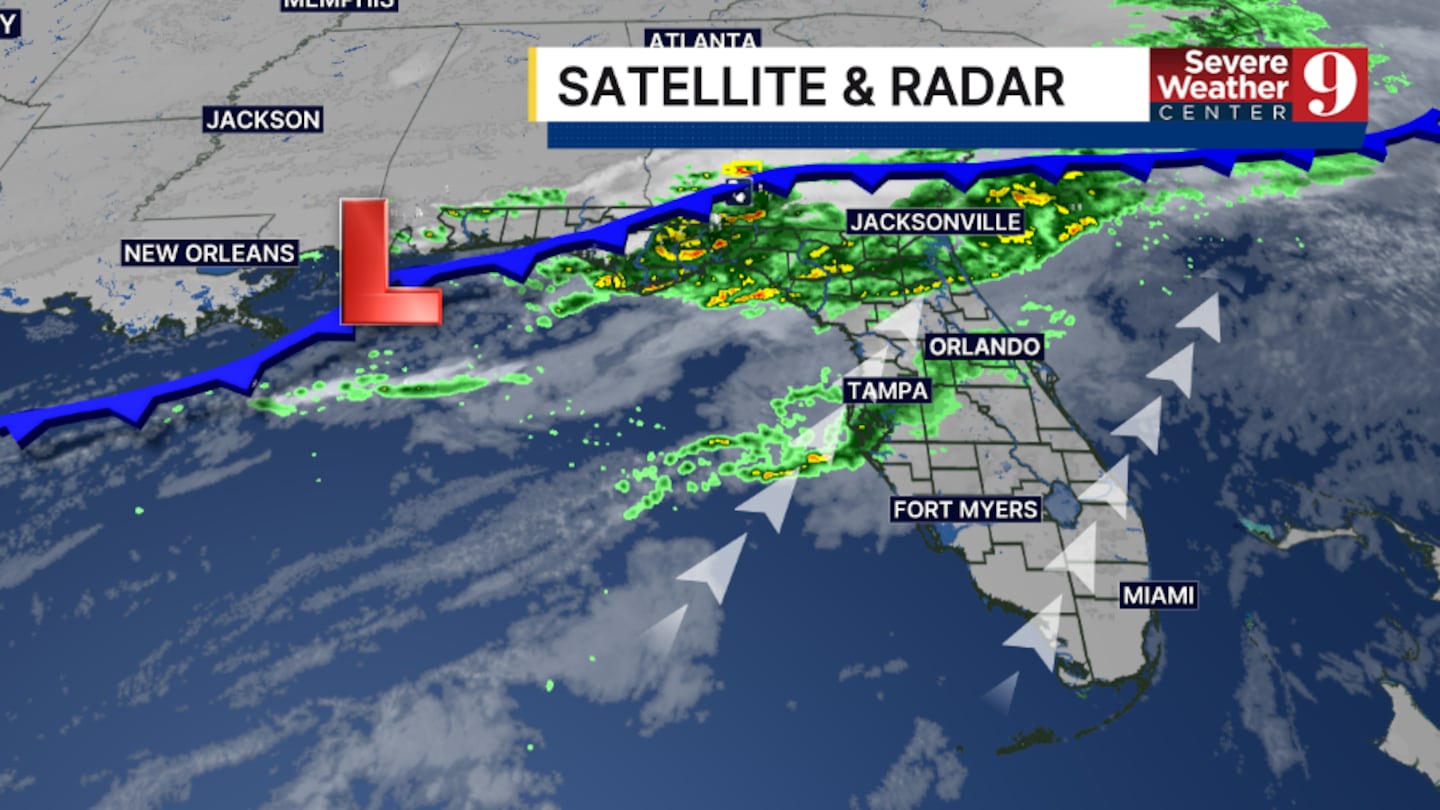
ORLANDO, Fla. — It has been a somewhat unsettled Saturday, and more rain is possible overnight.
A cold front is pushing toward the area, creating scattered showers and isolated storms. This activity will linger tonight, before waning in the early morning.
Areas of fog may also develop towards daybreak, with morning lows in the low 60s.
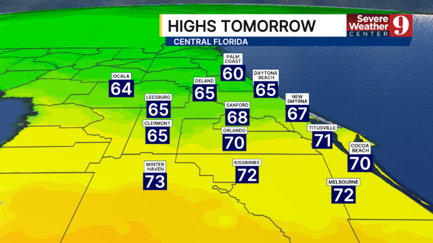
The cold front clears the area Sunday morning, bringing clouds and slightly cooler temps. Expect temperatures for Sunday to reach the low 70s.
We start the first whole week of 2026 with plenty of warmth across the region. A stray coastal shower will also be possible, with highs in the upper 70s.
The 80s make a return midweek as more warm air pushes into Central Florida. Temps both Tuesday and Wednesday will be in the low 80s with dry conditions.
More warm and dry weather is likely to close out next week, with temps holding in the low 80s.
Click here to download our free news, weather and smart TV apps. And click here to stream Channel 9 Eyewitness News live.

©2026 Cox Media Group


