
UPDATE:
ORLANDO, Fla. — The Weather On the Way is now starting on Sunday.
The fire threat is now increasing for the PM hours on Sunday.
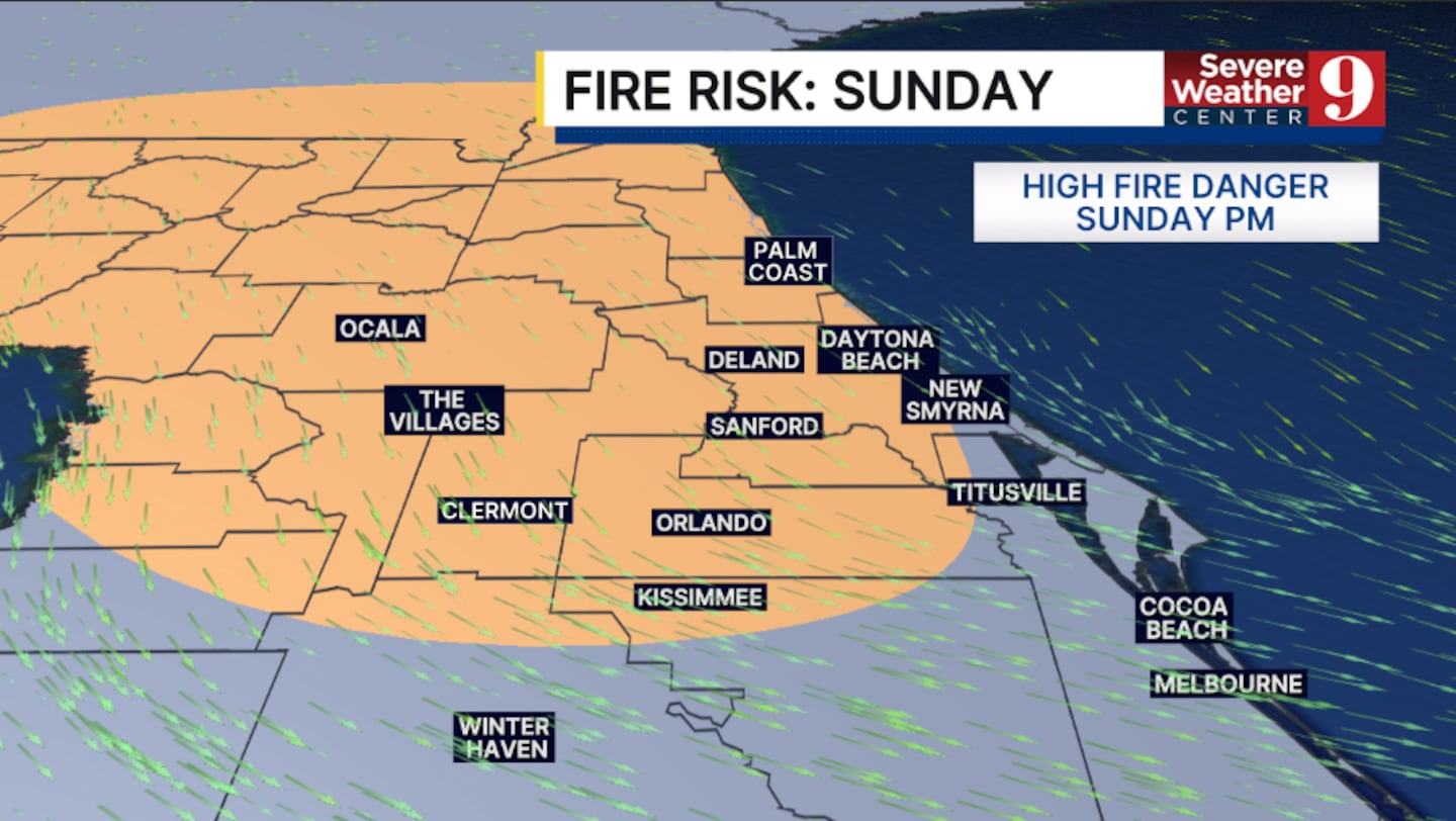
Areas along and north of State Road 50 have now been outlooked for a high fire threat on Sunday.
PREVIOUS STORY:
We have Weather On the Way for an elevated fire threat and another blast of cold air to start next week.
A strong cold front will push into Central Florida on Sunday, ushering in much drier, colder conditions.
Ahead of it, temps will continue to climb. Highs both Friday and Saturday will be close to record levels, with temps in the upper 80s.
Changes arrive early Sunday as the storm system pushes into the area. Scattered showers are likely on Sunday, with highs in the 70s.
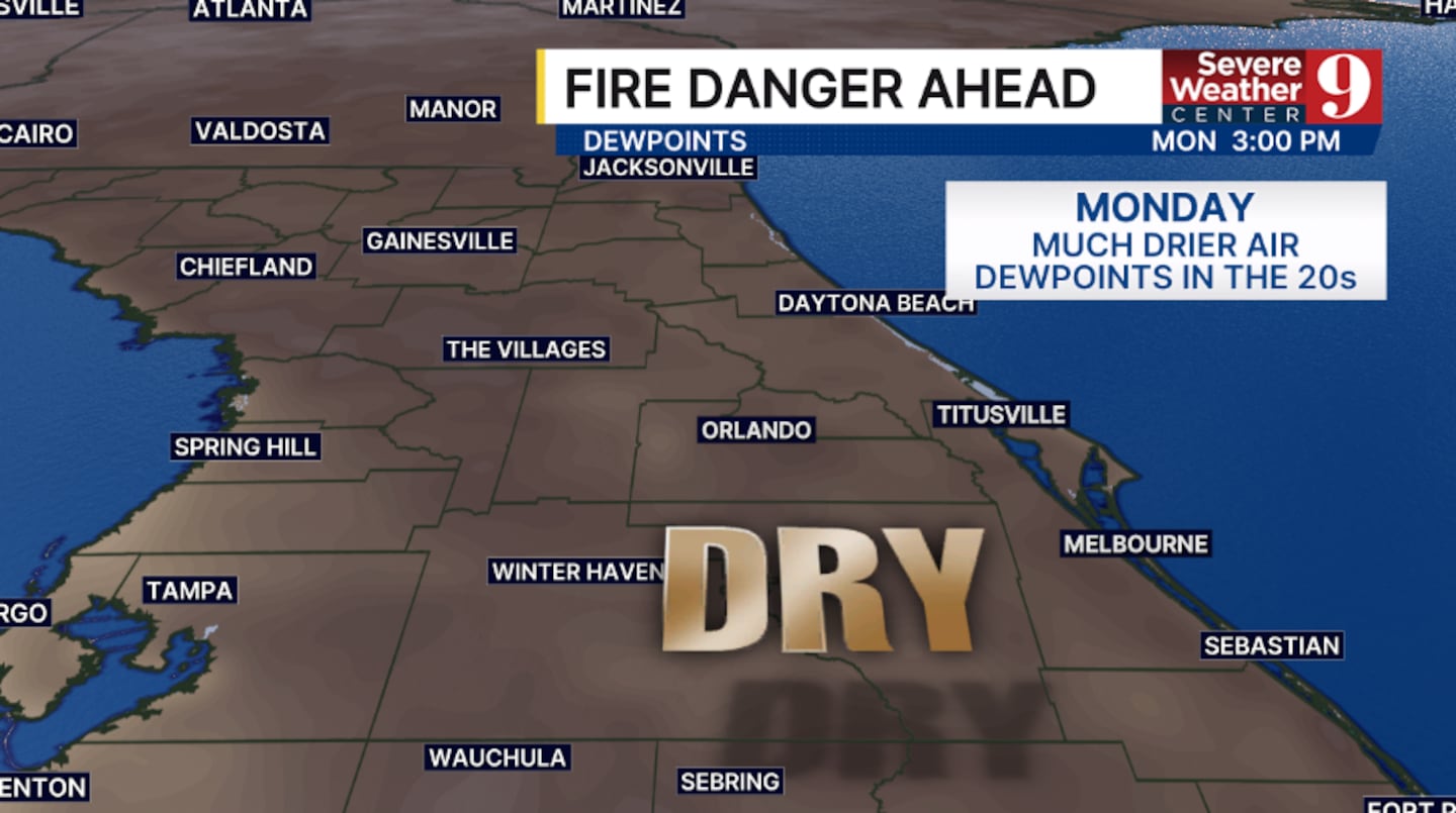
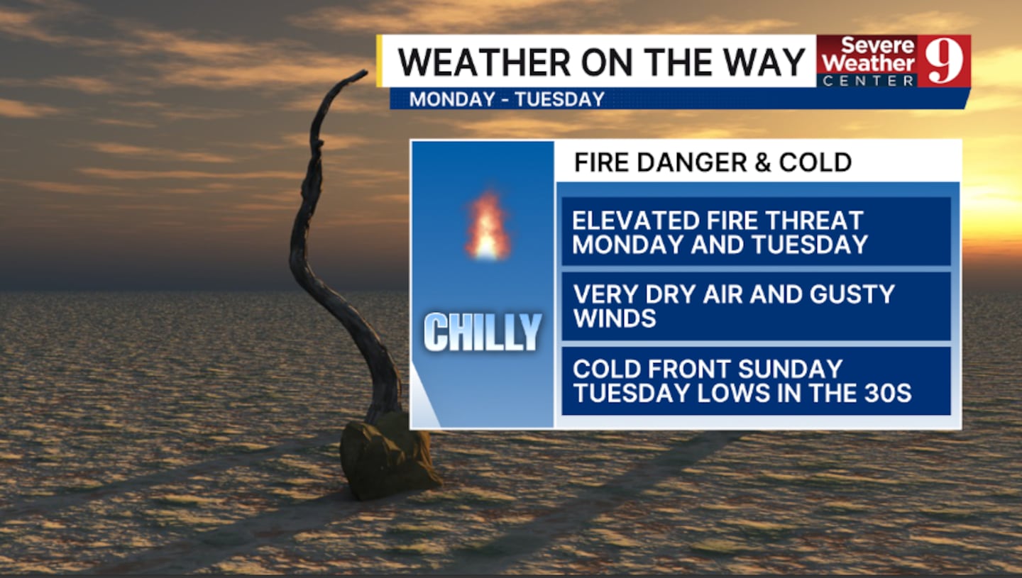
Very dry and cool air quickly pushes in on Monday. Gusty northwesterly winds and dry vegetation will lead to high fire danger on Monday and likely linger into Tuesday.
The cold air will also keep temperatures well below average. Highs on Monday and Tuesday will only be in the low 60s.
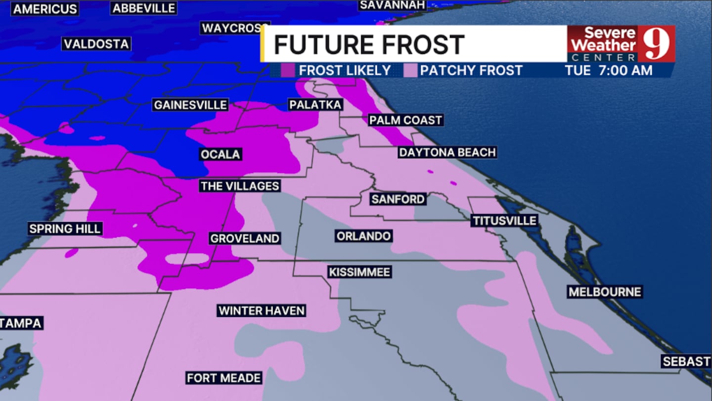
A freeze is becoming likely in northwest areas Tuesday morning, and a frost is very possible in parts of the area Wednesday morning.
Stay with Severe Weather Center 9 for the latest on the fire threat and the cold temps in the coming days.
Click here to download our free news, weather and smart TV apps. And click here to stream Channel 9 Eyewitness News live.

©2026 Cox Media Group


