
ORLANDO, Fla. — To the delight of many around Central Florida, warm temperatures look to be returning.
Thursday will be mostly sunny with temperatures sitting around the mid-70s. Winds have also picked up n response to the strong high-pressure system building over the eastern U.S. and western Atlantic.
Small craft advisories are in effect to local and offshore waters east of Florida. Boaters on lakes should also exercise caution as the winds will also be strong over inland areas.
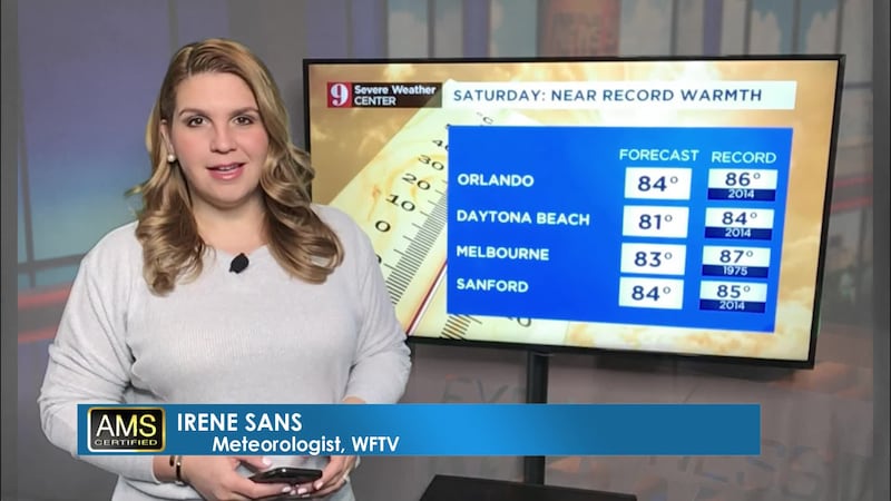
Local & offshore waters will be dangerous through Saturday along our east coast #Florida beaches.
— Irene Sans (@IreneSans) January 9, 2020
Although the 80s might sound tempting for the beach, it is not recommended. #flwx
Read more: https://t.co/AQdiwVV3mu pic.twitter.com/FvKSCxwuRd
Temps will dip into the mid 60s by Thursday evening.
Severe Weather on Saturday formed 2 tornadoes: EF-0 and EF1 in Lake and Volusia Counties
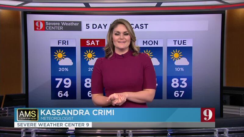
By the end of the week, high temperatures will be well above average for this time of the year, about 10 degrees above average. Highs will be in the 80s by Friday afternoon. The winds will be from the east starting Thursday which will pump up humidity levels and it will start to feel muggy by the weekend.
Catch up on your 5-day forecast:
Detailed daily weather report by digital certified meteorologist Irene Sans
Más información en español aquí: El tiempo para Florida Central:
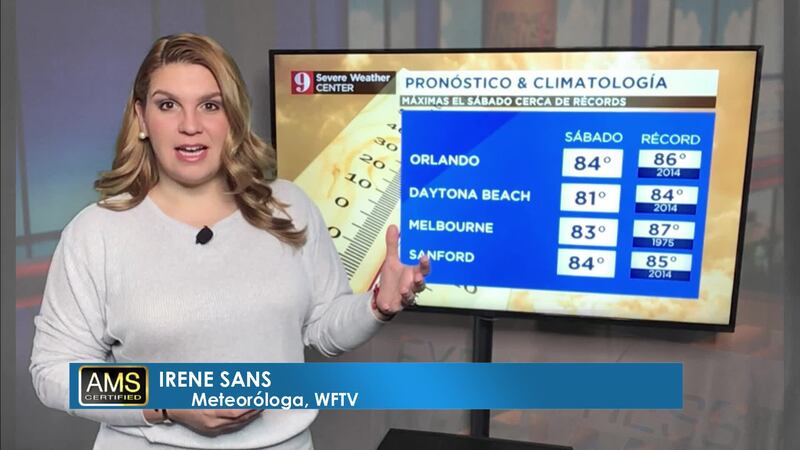
Pronóstico del tiempo en español por nuestra meteoróloga certificada Irene Sans
Follow our Severe Weather team on Twitter for live updates:
- Chief meteorologist Tom Terry
- Brian Shields
- Irene Sans
- Kassandra Crimi
- George Waldenberger
- Rusty McCranie
DOWNLOAD: Free WFTV News & Weather Apps
© 2020 Cox Media Group


