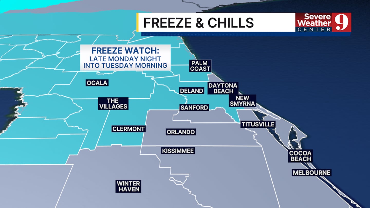
CENTRAL FLORIDA — We have weather on the way due to plunging temperatures starting Monday afternoon and lasting through Tuesday morning. A freeze watch has already been issued for parts of Central Florida.
Before we cool off, we could see record-breaking heat. Projected high temperatures today will be in the mid-80s. Orlando specifically could reach 86°, matching the record set in 2023.
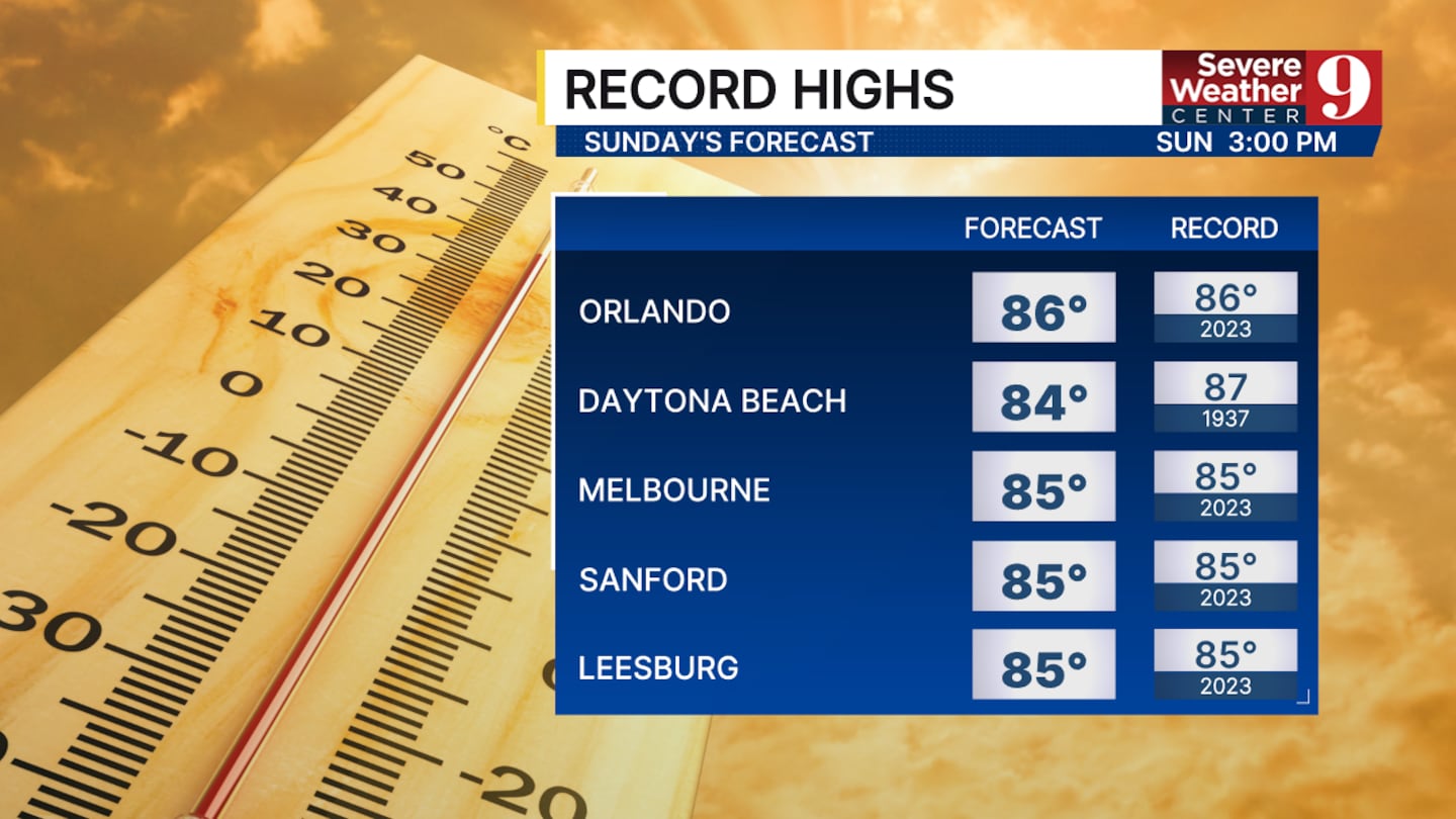
Melbourne, Sanford, and Leesburg also have the potential to break record highs today.
The incoming cold front that has caused many problems across the country will reach us in Florida late tonight. Clouds will build, and overnight lows will fall only to the upper 60s. Isolated to scattered rain chances will move through the area shortly after sunrise on Monday morning.
Rain totals will not be impressive, but they will indicate that the front has passed and that temperatures will begin to cool.
Overnight lows Monday night into Tuesday morning could reach the mid to upper 30s across the Orlando Metro area. As stated before, areas north of the city could fall below freezing. That is why the National Weather Service has issued a freeze watch for this time.
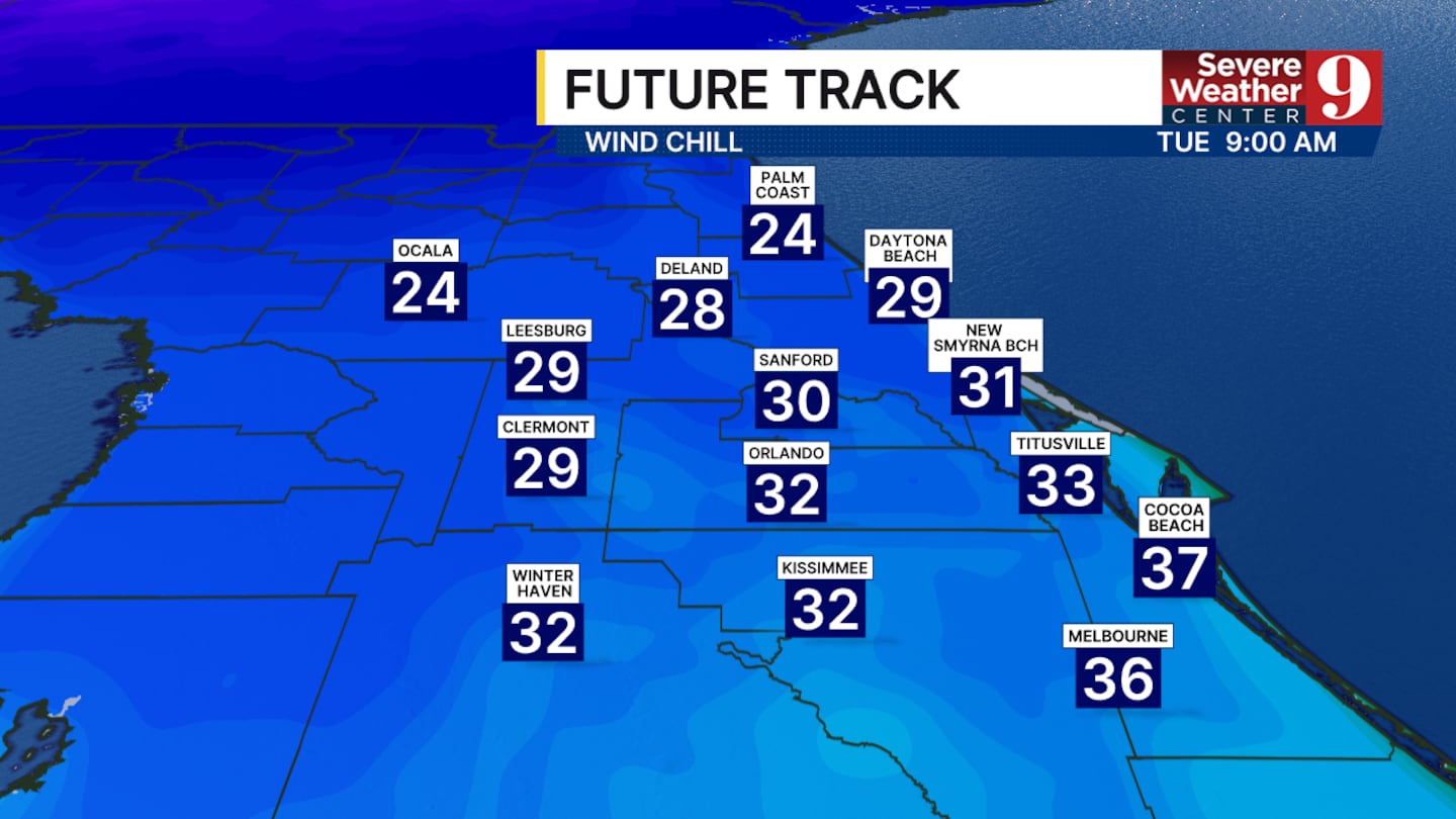
In Central Florida, the biggest factor for us will be the wind chill. Temperatures in Orlando may stop between 37° and 39°, but it will feel closer to freezing when you factor in the wind.
Most of this upcoming week will remain chilly before another front arrives this weekend.
Click here to download our free news, weather and smart TV apps. And click here to stream Channel 9 Eyewitness News live.

©2026 Cox Media Group


