
CENTRAL FLA. — Our Weather Alert Day remains on track, as minor flooding has begun and more significant flooding is becoming increasingly likely.
Periods of rain will continue this evening and tonight, with heavy rainfall possible.
The heavy rain will likely continue Thursday, with areas of flooding possible. The greatest threat for flooding remains along the coast.
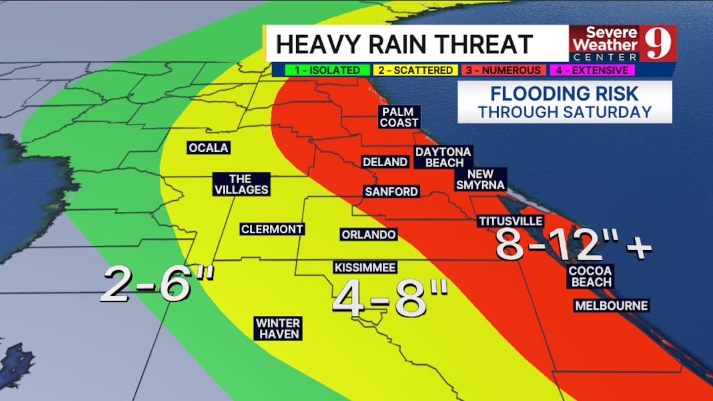
The threat for significant rain is increasing on Friday, as a coastal low develops to our southeast. Parts of Metro Orlando have now been placed in a Level 3 flood risk, and this may be extended into the remainder of the Metro should heavy rainfall occur tonight and Thursday.
The coastal low will lift northward Saturday. This could become a subtropical or tropical system. Its exact track will be critical to our weather.
Should it hug the coastline, heavy rain and very strong winds could develop.
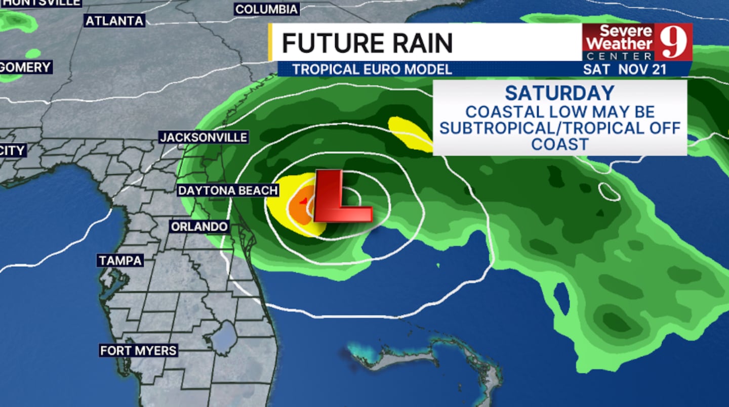
The complex pushes out of the area Sunday, finally bringing drier conditions back to the area.
Area-wide storm totals will likely be around 2-6” in inland areas, 4-8” in Metro Orlando, and 8-12” along the coast. Some areas of 12”+ remain possible along the coast.
Regarding the St. Johns River, it is again too early to know how much it will rise, but it will likely remain a concern through the rest of November.
Click here to download our free news, weather and smart TV apps. And click here to stream Channel 9 Eyewitness News live.

©2026 Cox Media Group


