
ORLANDO, Fla. — Thursday featured scattered storms across parts of the area, and higher storm coverage is likely for Friday.
The rain and storms will be slow to wind down this evening, with heavy rainfall possible. The activity will end overnight, with morning lows in the mid 70s.
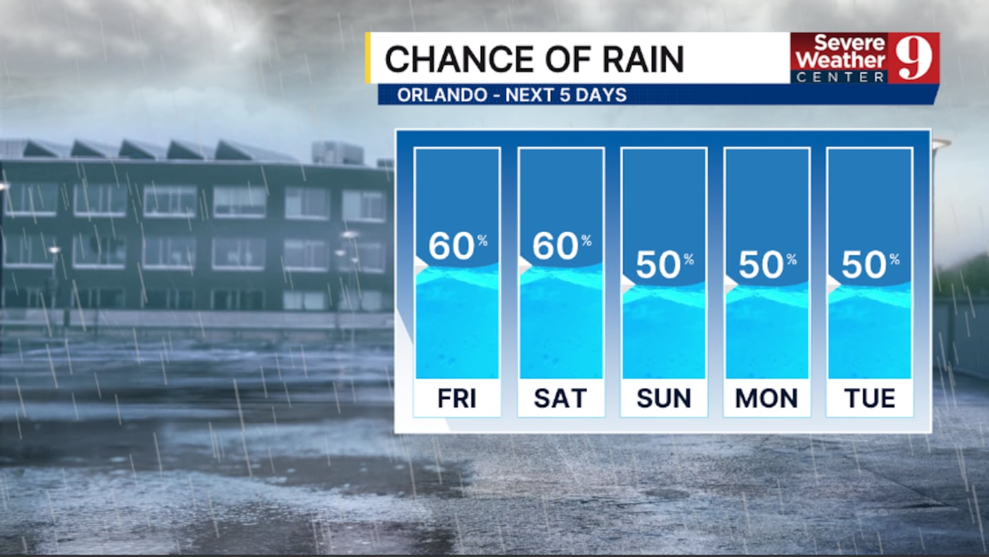
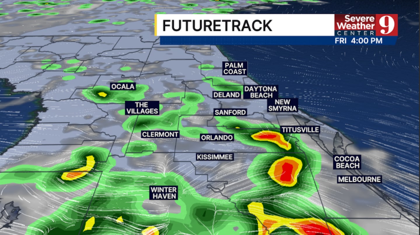
Higher rain and storm coverage arrives to close out the work week. The best chance for activity will be in the afternoon and evening, and heavy rainfall will again be possible. Highs for Friday will be in the low 90s.
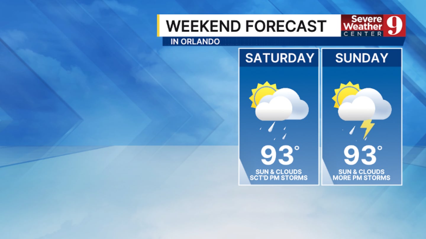
The storm threat continues into the weekend. A westerly wind will push more storm activity toward the coast on Saturday, with temperatures in the low 90s.
Slightly lower coverage of rain and storms is anticipated for Sunday, but many will still see rain. Highs to close out the weekend will be in the low 90s.
The typical rainy season weather pattern continues into the start of next week. We’ll see decent storm chances both Monday and Tuesday, with highs in the low 90s.
More rain and storms are likely for the middle of next week, with temperatures holding in the low 90s.
Click here to download our free news, weather and smart TV apps. And click here to stream Channel 9 Eyewitness News live.

©2026 Cox Media Group


