
ORLANDO, Fla. — With high pressure and dry air coming through, temperatures are expected to rise over the next few days.
Afternoon high temperatures might reach record levels by Friday and Saturday this week.
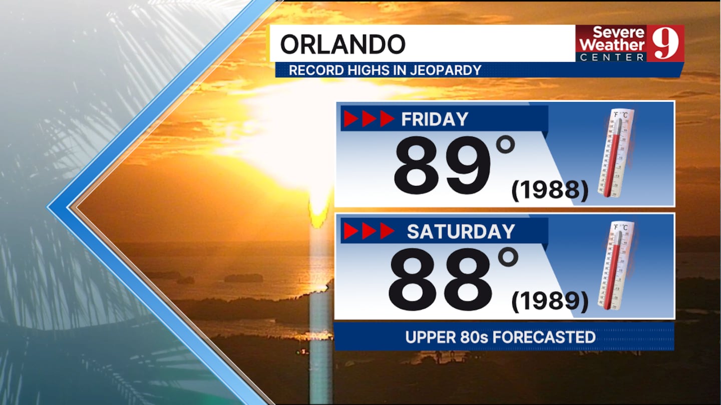
This is caused by high pressure building over the southeast. Steady winds will also come from the southwest.
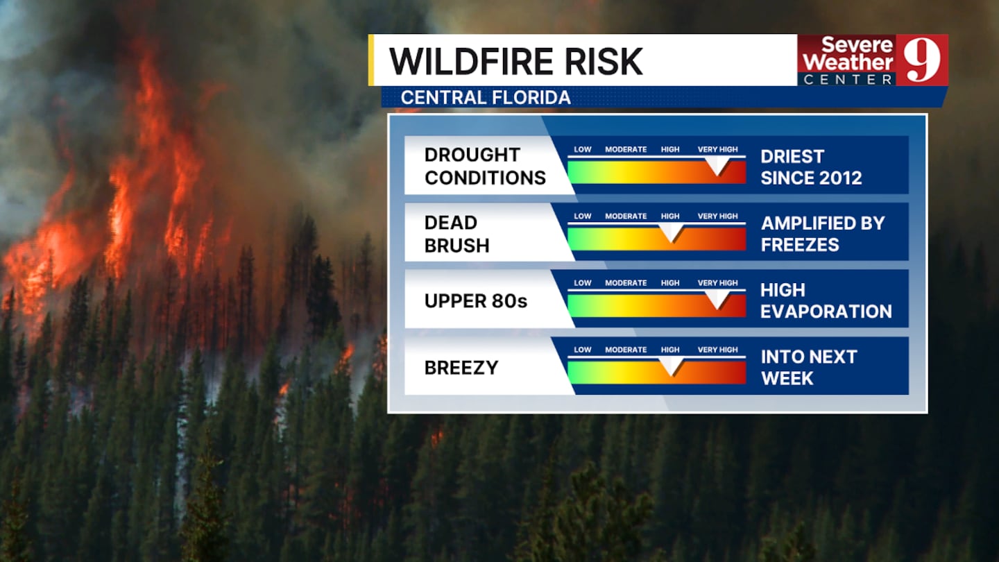
The fire danger we’ve been warning you about for the past few weeks will keep increasing.
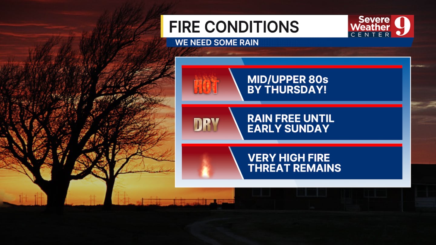
Factors such as a significant drought, limited recent rainfall, an abundance of dry brush, and rising temperatures suggest that if a fire starts, it could spread very quickly in central Florida.
Our next chance of rain will arrive on Sunday. We don’t expect much, less than half an inch across all locations, but it will significantly lower our temperatures to start the week.
No severe weather is expected with this system.
Click here to download our free news, weather and smart TV apps. And click here to stream Channel 9 Eyewitness News live.

©2026 Cox Media Group


