
CENTRAL Fla. — Heavy storms are impacting the Central Florida area
ORANGE COUNTY:
The T-Storm Warning issued for southwestern Orange and northwestern Osceola counties has been cancelled.
5:15 P.M.
A T-Storm Warning has been issued for southwestern Orange and northwestern Osceola counties until 5:15 PM.
This includes Orlando, Kissimmee, and Celebration
Movement is to the north at 15 mph.
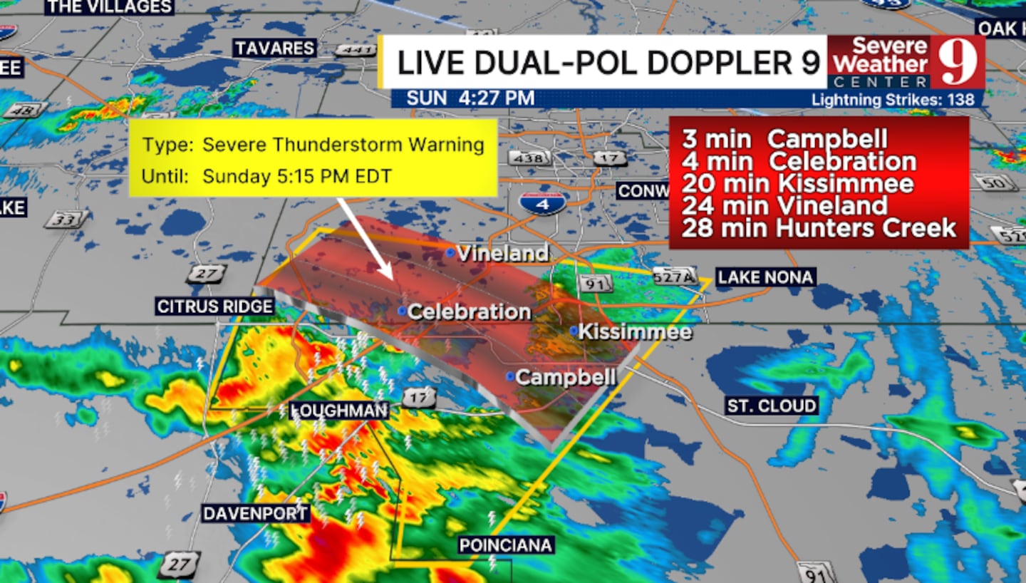
The greatest threats are winds over 50 mph, intense lightning, and hail.
This storm will impact much of Metro Orlando through 6 pm.
Additional strong to severe storms remain possible across all of Central Florida late this afternoon into this evening.
BREVARD COUNTY:
5:00 P.M.
A T-Storm Warning has been issued for central Brevard County until 5:00 PM.
This includes Titusville, Rockledge, and Cocoa Beach
Movement is to the north at 30 mph.
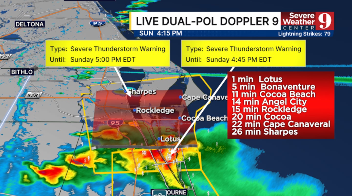
Greatest threats are winds over 50 mph, intense lightning, and large hail.
Large hail and wind gusts over 60 mph have been reported with this storm in South Brevard County
Additional strong to severe storms remain possible across all of Central Florida late this afternoon into this evening.
4:45 P.M.
A T-Storm Warning has been issued for southeastern Brevard County until 4:45 PM.
This includes Palm Bay and Melbourne.
Movement is to the north at 20 mph.
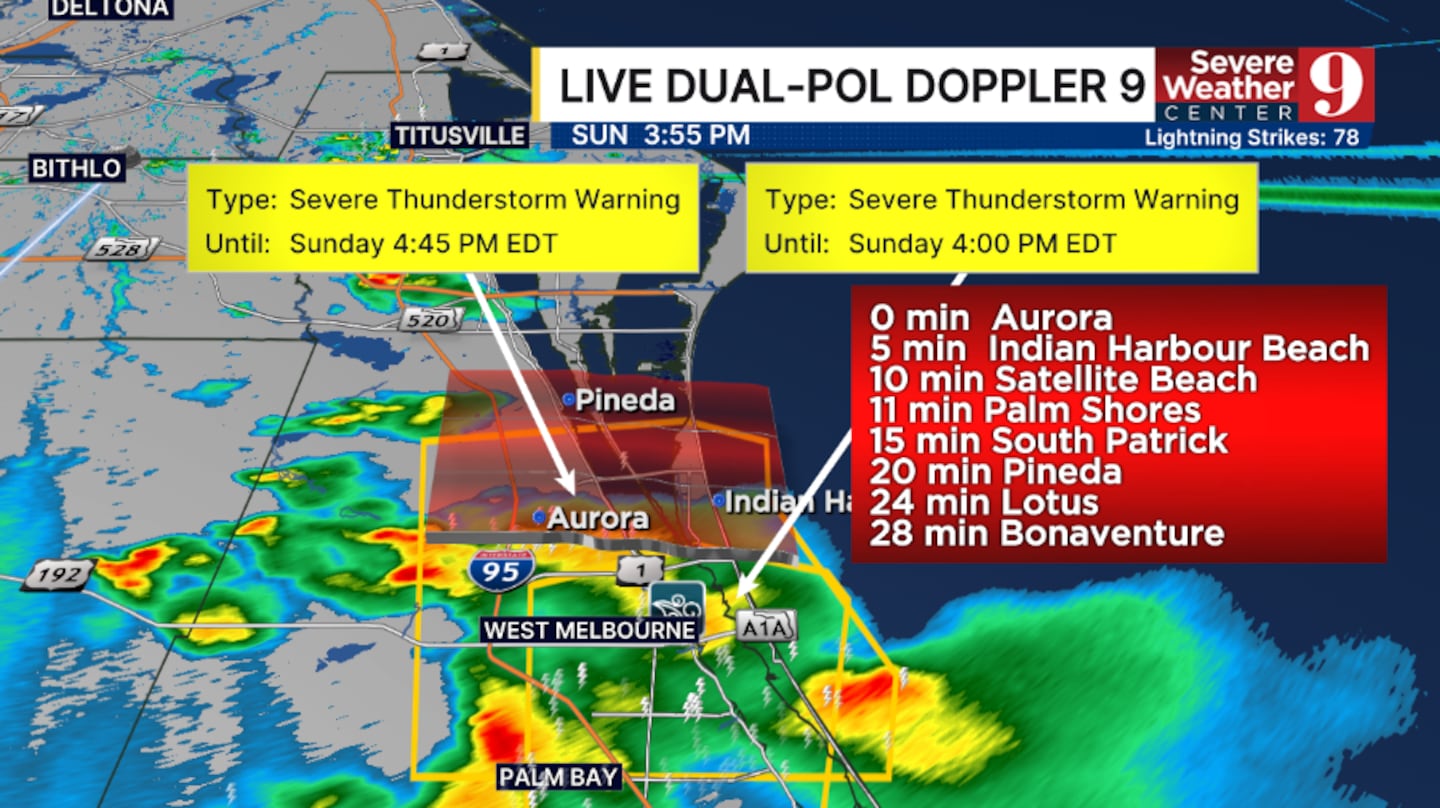
The greatest threats are winds over 50 mph, intense lightning, T-Storms, and large hail.
Golf ball-sized hail and wind gusts over 60 mph have been reported with this storm.
ball-sized
4:00 P.M.
A T-Storm Warning has been issued for southeastern Brevard County until 4:00 PM.
This includes Palm Bay and Melbourne.
Movement is to the north at 25 mph.
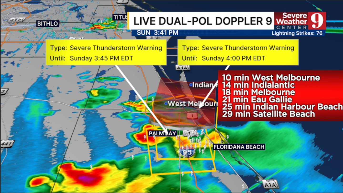
Greatest threats are winds over 50 mph, intense lightning, and hail.
Additional strong to severe storms remain possible across Central Florida during the late afternoon and early evening hours.
Click here to download our free news, weather and smart TV apps. And click here to stream Channel 9 Eyewitness News live.

©2026 Cox Media Group


