ORLANDO, Fla. — A tropical disturbance moving along Mexico’s eastern coastline is showing increasing signs of development as it drifts toward the western Gulf of Mexico.
The system is now raising concerns about heavy rainfall across parts of Texas, Louisiana, and the Deep South.
Forecasters have been monitoring the area of low pressure for several days.
The system now has a 60% chance of tropical development over the next 48 hours, a significant increase compared to projections from the weekend.
Meteorologists say changing weather conditions over Mexico are helping improve the system’s chances of organizing.
Stronger west winds developing across the region are expected to push the disturbance into the western Gulf, where warmer waters and favorable atmospheric conditions could allow it to strengthen into a weak tropical depression.
Whether the system officially develops or not, heavy rainfall is expected to be the primary concern.
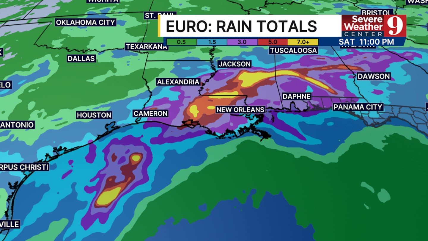
Across Texas, widespread rainfall totals of 2 to 4 inches are possible over the coming days.
The greatest impacts are expected in Louisiana, where some communities between Lake Charles and New Orleans could receive up to 7 inches of rain.
Areas north of Lake Pontchartrain are also expected to see significant rainfall totals, increasing the risk of localized flooding.
The moisture associated with the system will continue tracking inland, bringing periods of heavy rain to central Mississippi and northern Alabama before gradually weakening and dissipating.
At this time, forecasters say Florida is not expected to experience any significant impacts from the system.
Little to no effects are anticipated across the Sunshine State as the disturbance remains well west of the region.
Click here to download our free news, weather and smart TV apps. And click here to stream Channel 9 Eyewitness News live.

©2026 Cox Media Group


