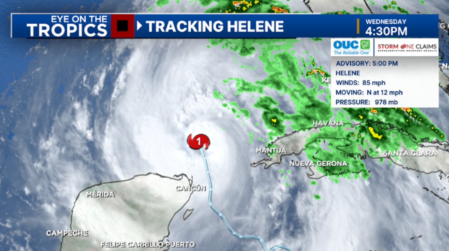
ORLANDO, Fla. — Hurricane Helene formed Wednesday morning near the Yucatan Peninsula.
▶ WATCH CHANNEL 9 EYEWITNESS NEWS

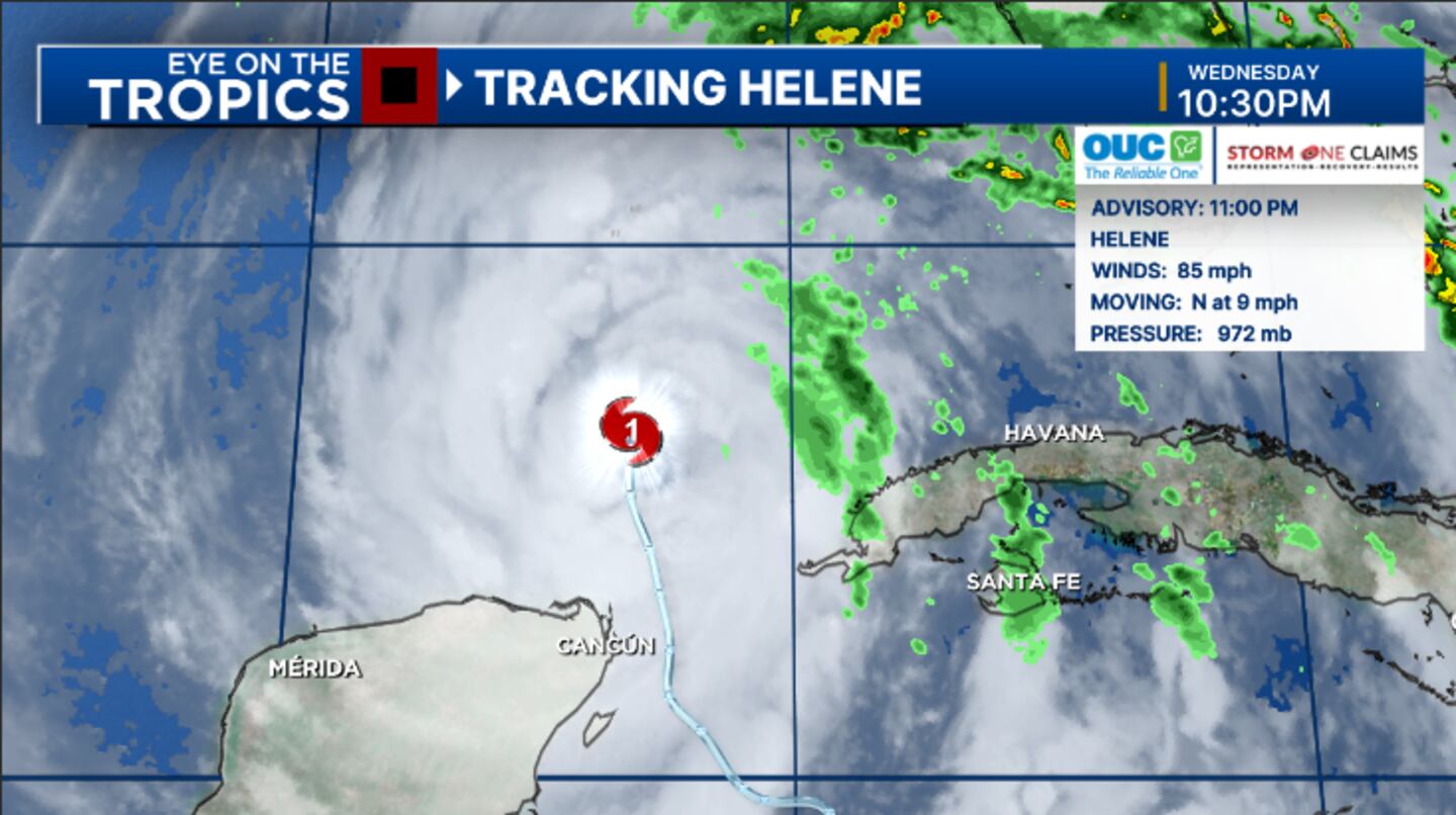
11 p.m. update:
Helene remains a Category 1 hurricane with winds of 85 miles per hour.
Helene is moving through the Gulf of Mexico and is still on track to be a Category 4 major hurricane at landfall Thursday.
The 11 p.m. advisory from the National Hurricane Center estimated maximum sustained winds to be 85 mph, making Helene a Category 1 hurricane.
The minimum pressure has dropped to 972 mb, an indication that the storm will continue to intensify.
Helene is still expected to rapidly intensify in the next 24 hours.
The latest forecast has Helene as a Category 2 storm Thursday morning and becomes a Category 4 major hurricane on Thursday afternoon.
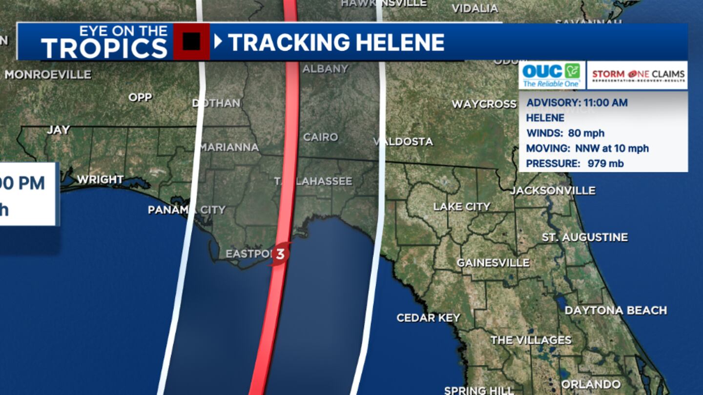
It is becoming highly likely the storm will be a major hurricane at landfall in the Big Bend area.
A catastrophic storm surge of 15-20 feet is now forecast for Apalachee Bay and portions of the northern Big Bend, with the threat for widespread hurricane-force winds increasing.
Tropical Storm Warnings continue for the vast majority of Central Florida, with a Hurricane Warning for western Marion County.
Conditions will worsen as the day progresses Thursday, as Helene quickly lifts northward.
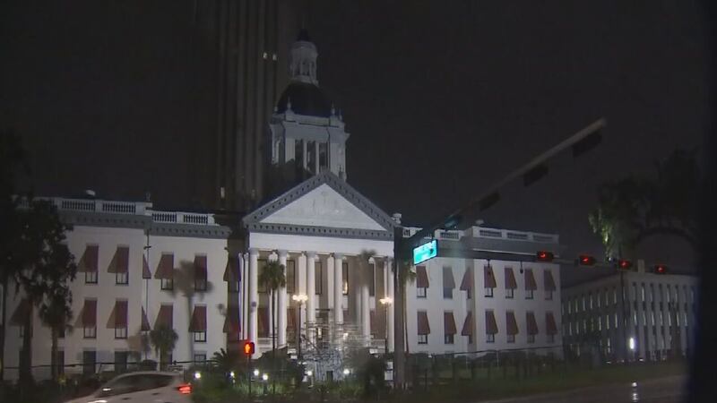
Helene Channel 9′s Shannon Butler was live from Tallahassee, where the storm is expected to hit hard.
See Video Below:
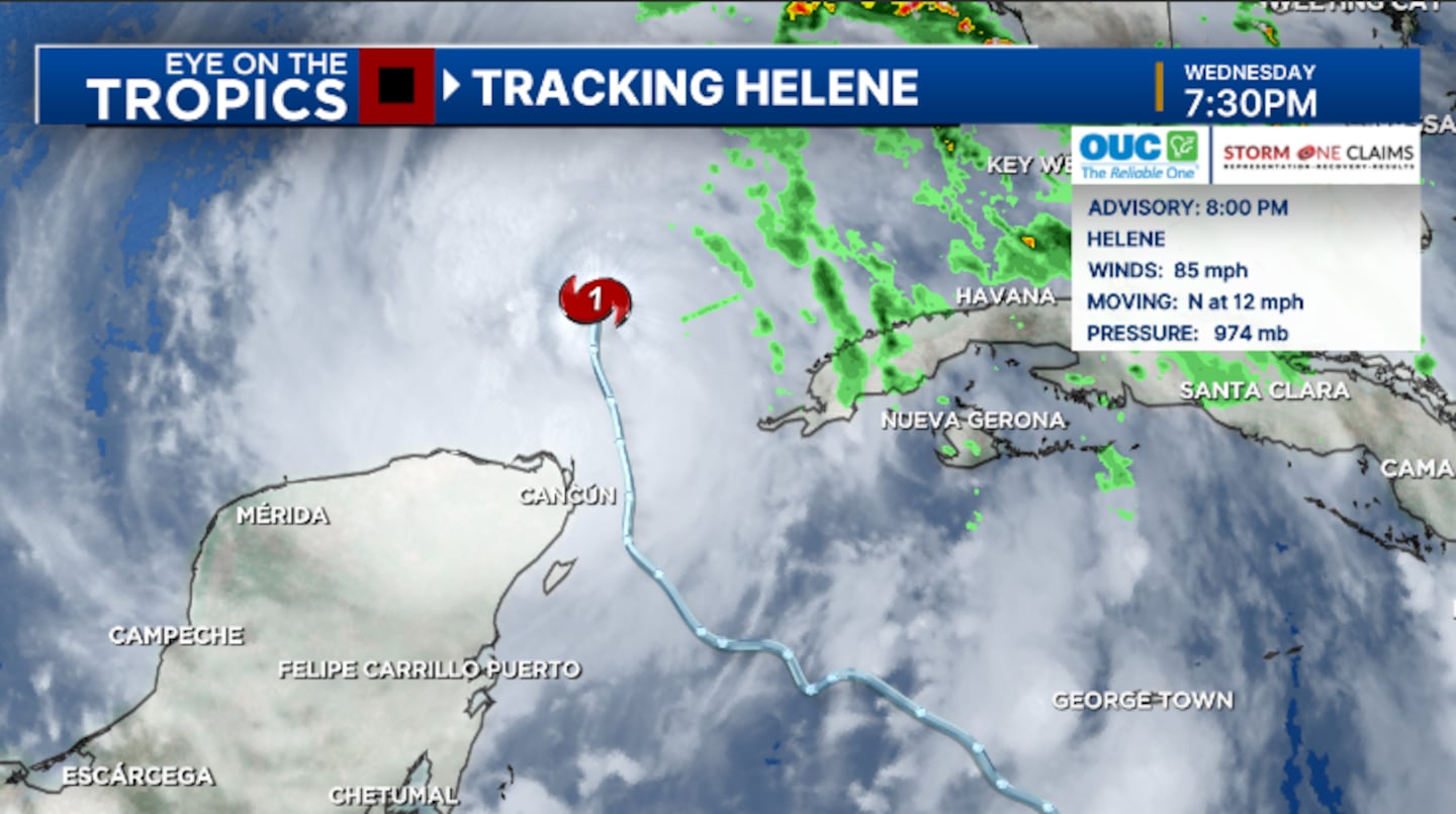
8 p.m. update:
Helene continues to intensify Monday evening and is now forecast to become a Category 4 major hurricane near landfall.
The 8 p.m. advisory from the National Hurricane Center estimated maximum sustained winds to be 85 mph, making Helene a Category 1 hurricane.
The barometric pressure has dropped to 974 mb, showing a continued sign of intensification.
The hurricane continues to move north in the southern Gulf of Mexico, and is still expected to rapidly intensify in the next 24 hours.
The latest forecast has Helene as a Category 2 storm Thursday morning and becomes a Category 4 major hurricane on Thursday afternoon.
6 p.m. update:
Sumter County residents are preparing for the impacts of Hurricane Helene.
Channel 9′s Sabrina Maggiore spoke to residents in the Lake Panasoffkee community, who said they will hunker down together during the storm.
“Neighbors look out for one another. Some of the elderly people, we always check on them make sure they’re going to be alright,” said Charles Pennington, who has lived in Lake Panasoffkee for several decades.
Click here for more details.
5 p.m. update:
Helene continues to intensify Wednesday evening and is now forecast to become a Category 4 major hurricane near landfall.
The 5 p.m. advisory from the National Hurricane Center estimated maximum sustained winds to be 85 mph, making Helene a Category 1 hurricane.
The hurricane has now entered the Gulf of Mexico, and is expected to rapidly intensify in the next 24 hours.
The latest forecast has Helene as a Category 2 storm Thursday morning and becomes a Category 4 major hurricane on Thursday afternoon.
It is likely the storm will be a major hurricane at landfall in the Big Bend area.
A catastrophic storm surge of 15-20 feet is now forecast for Apalachee Bay and portions of the northern Big Bend.
Tropical Storm Warnings continues for the vast majority of Central Florida, with a Hurricane Warning for western Marion County.
Storm preparations should be completed tonight, as conditions will rapidly worsen during the morning hours on Thursday.
4 p.m. update:
All Central Florida school districts are closed for Thursday, Sept. 26 due to the storm.
Some colleges and universities are also included in the list.
See the full list of closures here.
Several theme parks are closing because of Helene. Click here for that list.
You can also see the shelters opening in Central Florida.
3:45 p.m. update:
Hurricane Helene is moving Into the Southeastern Gulf of Mexico.
The National Hurricane Center suggests that “Preparations to Protect Life and Property From Storm Surge and Damaging Winds Along the Florida Big Bend Coast Should Be Rushed to Completion Today.”
11 a.m. update:
The National Hurricane Center confirmed Helene has strengthened into a Category 1 storm.
Hurricane Helene is moving north-northwest at 10 mph and has maximum sustained winds of around 80 mph.
Watch: Action 9: How to prepare before the storm
The hurricane is expected to rapidly intensify as it lifts into the Gulf of Mexico.
The latest forecast has Helene as a Category 2 storm Wednesday evening and becomes a Category 3 major hurricane on Thursday.
11 AM WED UPDATE:#Helene has become a hurricane, with winds of 80 mph.
— David Heckard (@DHeckardWFTV) September 25, 2024
TS Warnings continue for much of C. FL, with Hurricane Warnings for Big Bend/Panhandle.
Still on track for a major hurricane strike in Big Bend area Thu PM.
I'll have latest at Noon on @WFTV #flwx pic.twitter.com/rE0AQOyoJt
It is likely the storm will be a major hurricane at landfall in the Big Bend area.
Helene is expected to bring life-threatening storm surges, damaging winds, and flooding rains to a large portion of Florida and the southeastern United States.
10:05 a.m. update:
President Joe Biden approved an emergency declaration for Florida on Wednesday.
The action authorizes FEMA to coordinate disaster relief efforts in the state.
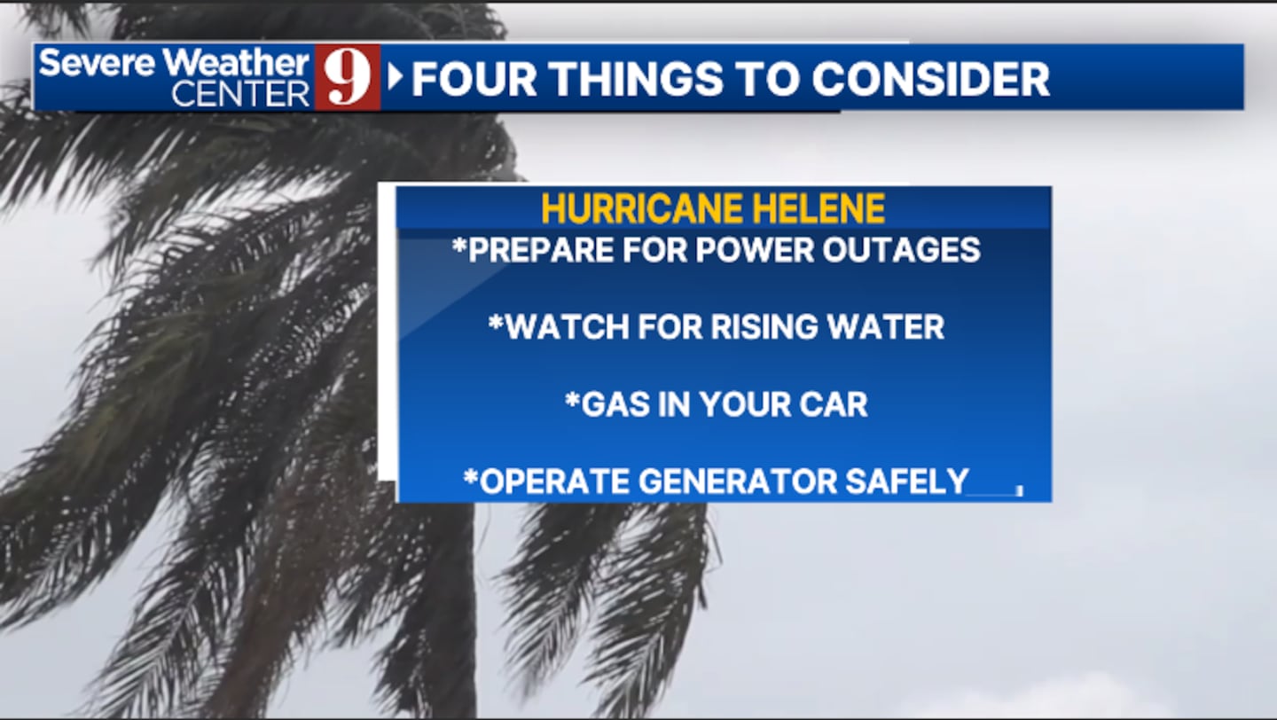
Read: Hurricane tips: What you should do to prepare
Officials said federal funding is also available to provide emergency assistance for Alachua, Bradford, Columbia, Escambia, Hamilton, Holmes, Marion, Okaloosa, Santa Rosa, Sumter, Union, Walton and Washington counties.
Tropical Storm Helene is just offshore the northeastern coast of the Yucatan Peninsula and is close to hurricane strength.
Original report:
As of Wednesday morning, Helene’s track is still aiming to impact the Big Bend area of Florida.
The storm is sitting off the coast of the Yucatan Peninsula.
Photos: Tropical Storm Helene gains strength as hurricane warnings issued in part of Florida
Helene will follow a similar track as Hurricane Debby and Hurricane Idalia.
Helene is forecast to become a major hurricane before making landfall Thursday night in Florida.
Watch: Parts of Florida still recovering from Hurricane Debby prepare for Helene
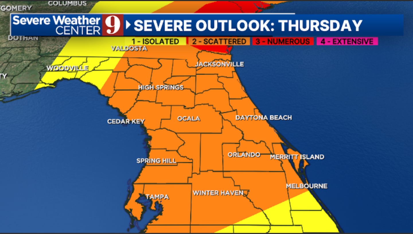
Our biggest threat in Central Florida will be from Helene’s rain bands.
Those storms had a chance of producing isolated tornados, especially Thursday evening.
Watch: See where you can get sandbags in Central Florida
Spotty power outages and localized flooding are possible.
As of Wednesday morning, the worst weather will stay west of Central Florida.
Channel 9 will continue to monitor Helene and provide updates on Eyewitness News.
Follow our Severe Weather team on X for live updates:
©2024 Cox Media Group
