CENTRAL FLORIDA — Another round of cold will arrive late Sunday into Monday, thanks to another strong cold front moving into Central Florida tomorrow.
Temperatures will rebound a bit today, reaching the upper 60s and lower 70s across most of the region. Overnight, the increased humidity will begin to prevent our overnight lows from falling below the mid 50s.

That front that will move in on Sunday will take advantage of that humidity and bring decent rain chances by the late morning and early afternoon.
No severe weather or heavy rain is expected, but wind gusts of 30-35 mph will be possible.
Those winds will translate into a strong wind chill for the rest of the day Sunday and into Monday morning.
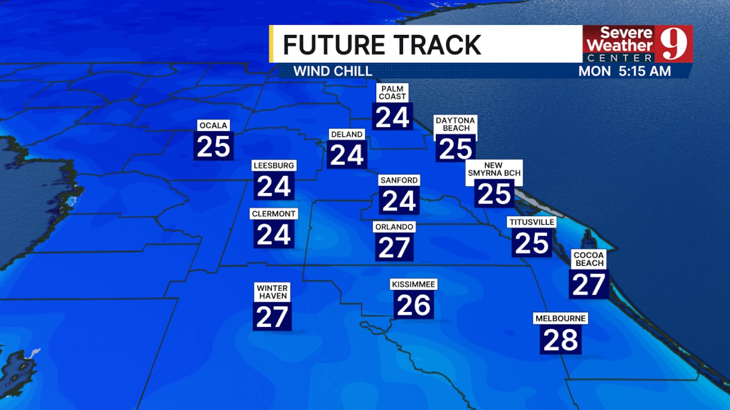
We may even have wind chills in the upper 30s shortly after sunset around the Orlando Metro area.
The actual temperatures after the cold front could drop to what we saw Friday morning.
Depending on how quickly the front moves through and how dry the air becomes, Orlando has a chance to reach the freezing point again.
A freeze watch has already been posted for the vast majority of central Florida, excluding Brevard County.
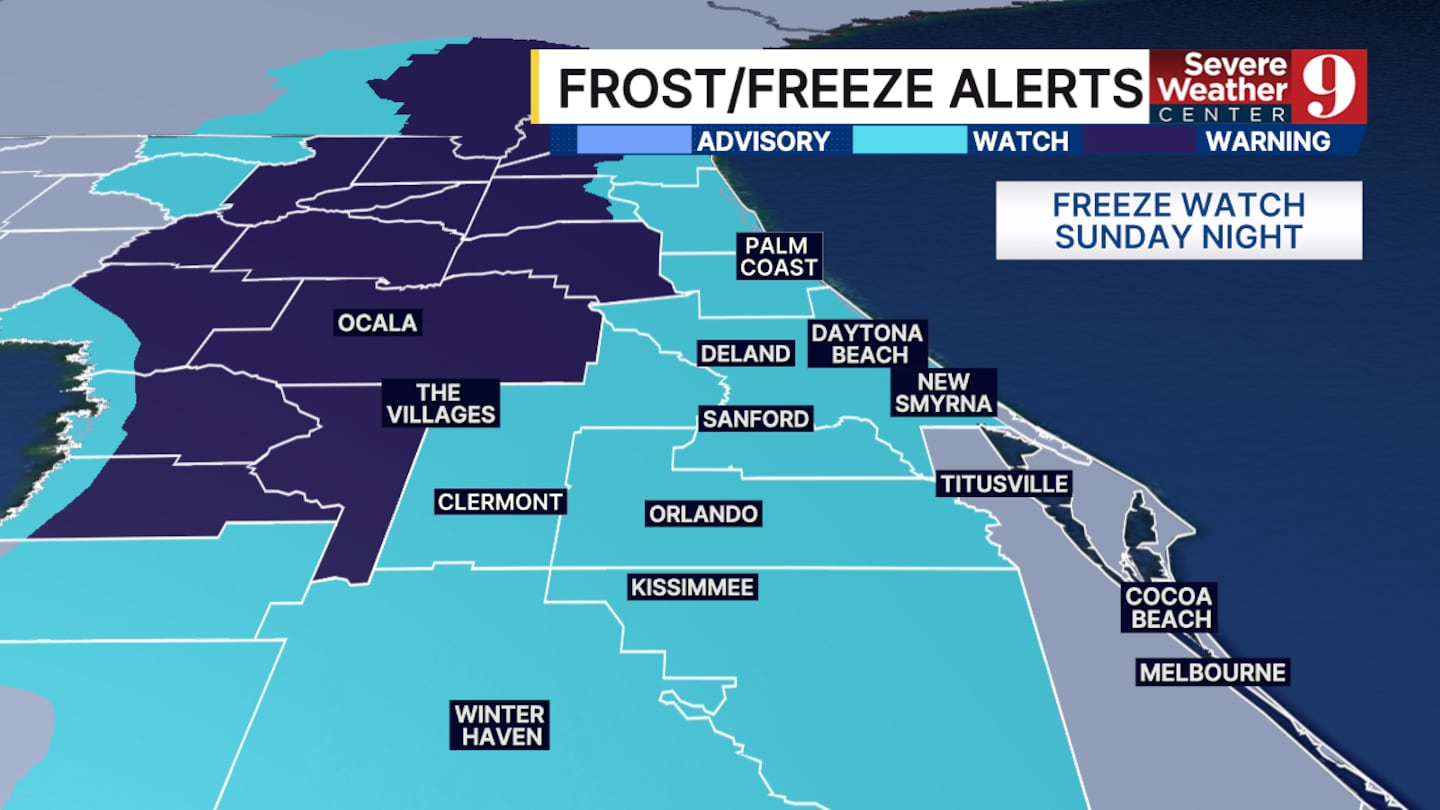
A freeze warning has been issued for Sumter and Marion counties overnight Sunday into Monday.
We should begin to see temperatures return to near normal by either Wednesday or Thursday before another front moves into the area.
Click here to download our free news, weather and smart TV apps. And click here to stream Channel 9 Eyewitness News live.

©2026 Cox Media Group


