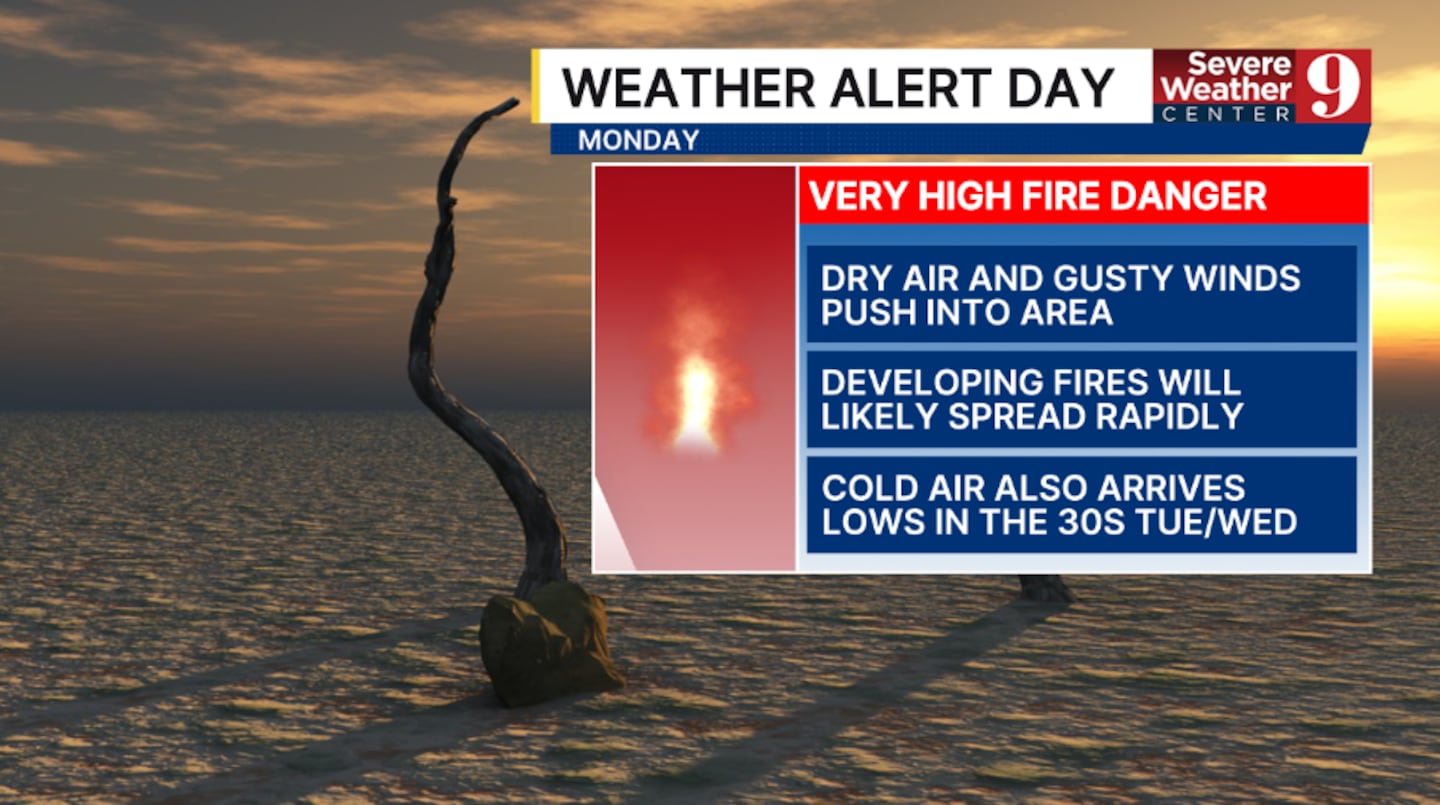
ORLANDO, Fla. — A Weather Alert Day is in effect for Monday as the fire threat increases across Central Florida.
A strong cold front will move into the area Sunday and bring the threat for wildfires and cold temps across the region.
Scattered showers will develop ahead of the front early Sunday, but some will stay dry. Highs for Sunday will be in the 70s.
Very dry and cool air moves in behind the front starting late Sunday.
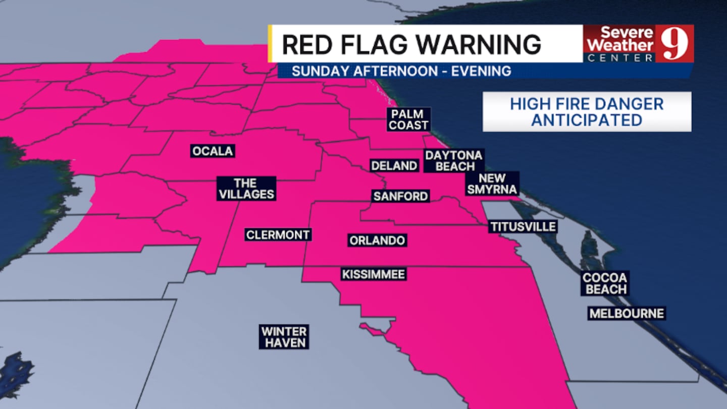
Gusty northwesterly winds and dry vegetation will lead to high fire danger, and a Red Flag Warning is now in effect across most of the area.
A Red Flag Warning means conditions are favorable for the rapid spread of brushfires.
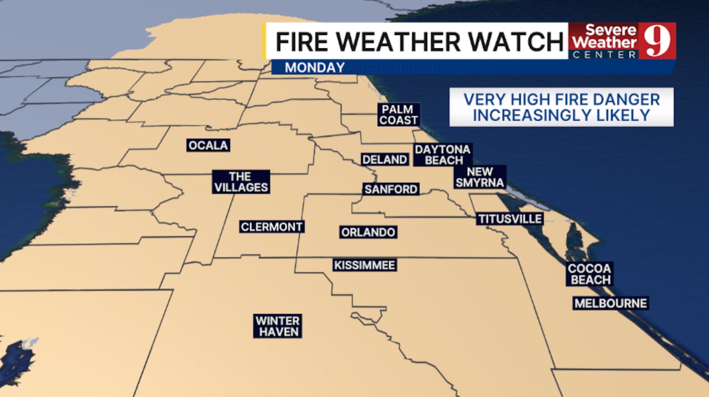
The fire danger continues to increase on Monday, with much of Central Florida under a Very High fire threat.
A Fire Weather Watch is already posted for Monday, and wildfires due the day will be capable of spreading rapidly.
The cold air behind the front will also keep temperatures well below average. Highs on Monday and Tuesday will only be in the 50s and low 60s.
The threat of a freeze continues to increase in northwest areas Tuesday morning, and a frost is becoming likely in parts of the area Wednesday morning.
Warmer weather does return for the back end of next week.
Stay with Severe Weather Center 9 for the latest on the Weather Alert Day on Monday.
Click here to download our free news, weather and smart TV apps. And click here to stream Channel 9 Eyewitness News live.

©2026 Cox Media Group