
CENTRAL FLA. — After a historic week of flooding, quieter weather returns for the weekend.
Some scattered showers will be possible tonight, but the heavy rainfall threat will be in North Florida. Morning lows will be in the upper 60s.
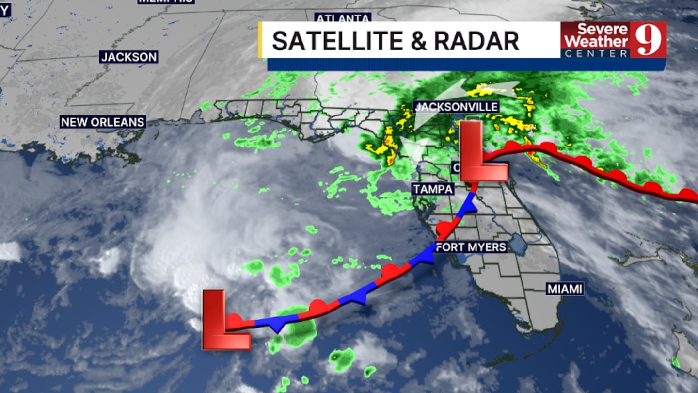
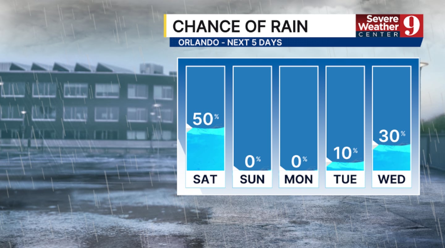
Saturday will also feature scattered showers and potentially a few storms across the region. The threat for heavy rain is expected to be low, with highs in the upper 70s.
Drier weather and sunshine return for the back end of the weekend. Expect partly cloudy skies for Sunday, with temps in the mid-70s.
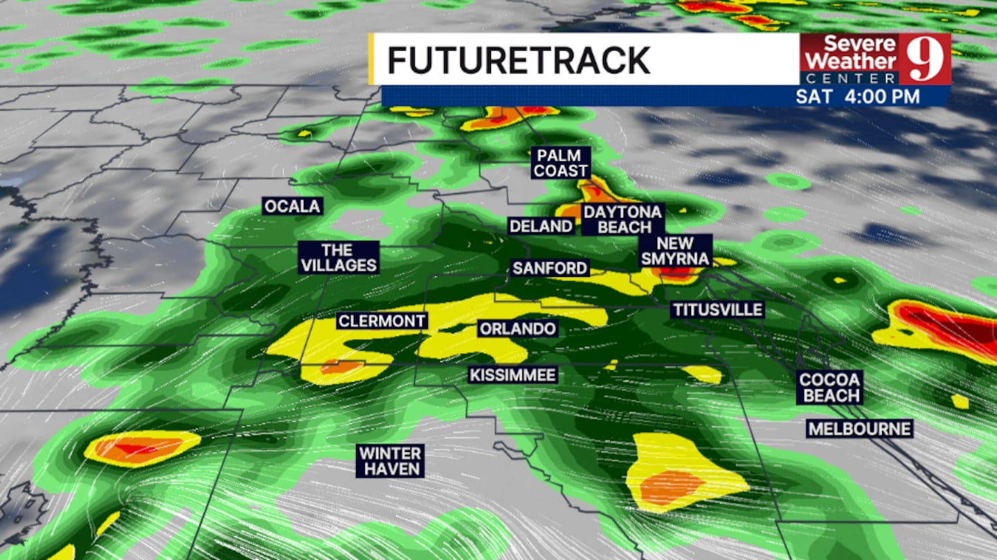
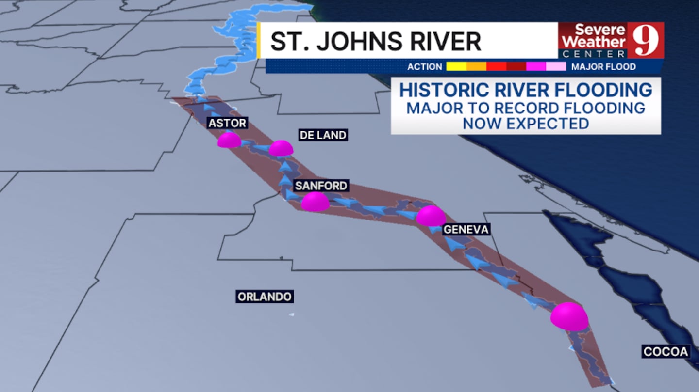
The flooding threat this weekend will be focused along the St. Johns River, where historic and major flooding is expected into next week.
Some more cloud cover is anticipated for Monday, but dry conditions will continue. Highs for Monday will be in the mid-70s.
A weaker storm system arrives for the middle part of next week, but only scattered showers are anticipated. Temps Tuesday and Wednesday will be in the mid-70s.
Right now, Thanksgiving Day and Black Friday look to feature partly sunny skies, a few showers, and cooler temps in the upper 60s.
Click here to download our free news, weather and smart TV apps. And click here to stream Channel 9 Eyewitness News live.

©2026 Cox Media Group


