ORLANDO, Fla. — The heat and humidity remain in place for Mother’s Day. Better thunderstorm chances are also expected during the afternoon.
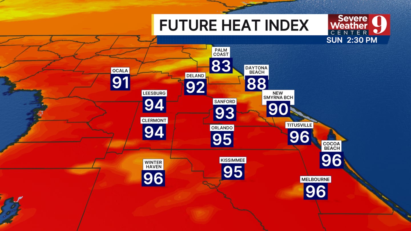
The temperatures are slowly beginning to drop. This does not mean that we will see any significant cooldown today. Afternoon high temperatures will still hover around 90°, with a heat index in the mid-90s.
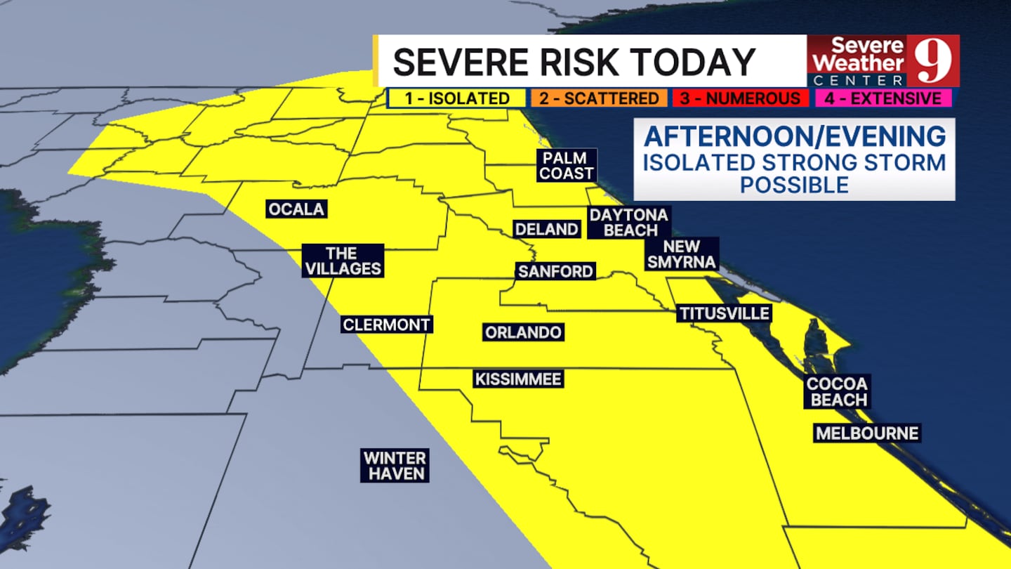
We are tracking a better chance of strong to severe storms this afternoon, especially along the coast.
This is still thanks to that stalled cold front to our north.
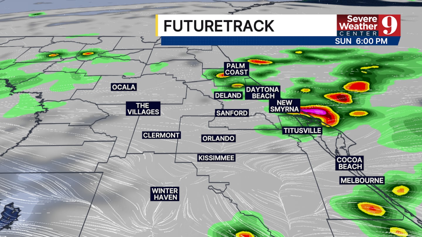
The timing of the storms will be a tad earlier than yesterday. We could see some storms develop as early as 2 to 3 p.m.
The main threats with the storms continue to be wind gusts up to 50 mph, heavy rain and frequent lightning. An isolated hail core for a brief spin-up cannot be ruled out.
The severe weather chances will begin to drop around sunset and the rain will slowly taper off before 10:00 p.m.
Another round of heat and storms is expected to start off the work week.
Click here to download our free news, weather and smart TV apps. And click here to stream Channel 9 Eyewitness News live.

©2026 Cox Media Group


