
CENTRAL FLORIDA — Multiple weather alerts have been posted for multiple Central Florida Counties as severe weather moves through the area. Please check all updates below for all warnings and end times.
4:15 UPDATE
The Tornado Watch has been canceled for Lake, Seminole, and Volusia counties.
The severe weather threat in those areas has ended.
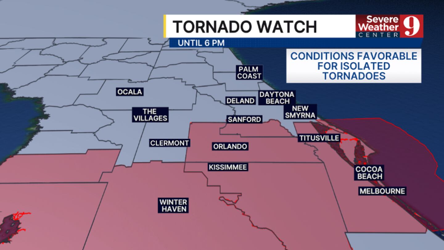
The Tornado Watch continues for areas along and east of the I-4 corridor until 6 pm.
2:58 UPDATE
The Tornado Watch has been canceled for Sumter County.
The severe weather threat in that area has ended.
The Tornado Watch continues for the remainder of Central Florida until 6 pm.

2:51 UPDATE
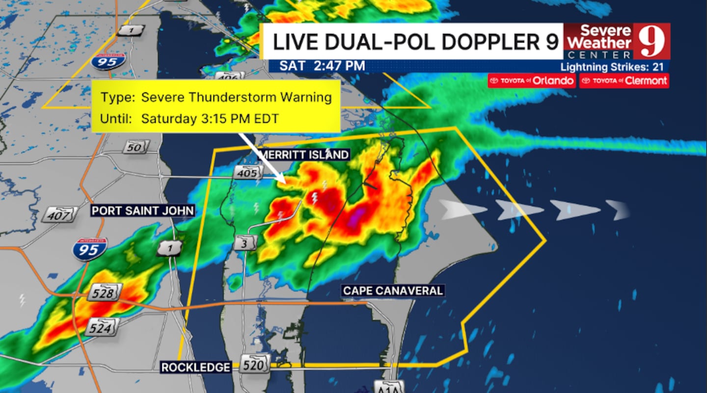
A Severe T’Storm Warning has been issued for northeastern Brevard County until 3:15 pm.
This includes Cape Canaveral and Cocoa Beach.
Movement is to the east at 30 mph.
Greatest threats are winds over 50 mph, intense lightning and large hail.
A Tornado Watch continues for the majority of Central Florida through 6 pm.
2:48 UPDATE
The Tornado Watch has been canceled for Marion and Flagler counties.
The severe weather threat in those areas has ended.
The Tornado Watch continues for the remainder of Central Florida until 6 pm.

canceled
2:25 UPDATE
A Severe T’Storm Warning has been issued for southeastern Seminole, northwestern Brevard and southeastern Volusia counties until 3 pm.
This includes Oak Hill.
Movement is to the east at 30 mph.
Greatest threats are winds over 50 mph, intense lightning and large hail.
A Tornado Watch remains in effect for all of Central Florida until 6 pm, and additional strong to severe storms are likely in the area this afternoon.

ORIGINAL STORY
A Severe T’Storm Warning has been issued for Seminole, central Orange, and south-central Volusia counties until 2:30 pm.

This includes Oviedo.
Movement is to the east at 20 mph.
Greatest threats are winds over 50 mph, intense lightning and large hail.
A Tornado Watch continues for all of Central Florida until 6 pm, and additional strong to severe storms are likely in the area this afternoon.

Click here to download our free news, weather and smart TV apps. And click here to stream Channel 9 Eyewitness News live.

©2026 Cox Media Group


